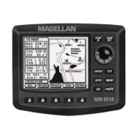
6-12
USING THE UNIT NEAR THE POLES
Since all meridians of longitude converge at the North and South
poles, a nautical mile can span many degrees of longitude near the
poles. This means that small changes in position can cause large
variations.
The inherent accuracy of the NAV 5000 does not change near the
poles, but this mathematical sensitivity problem can cause position
and
velocity-related data to appear unstable when the unit is
operated at
latitudes greater than 85 degrees north or south of the
equator. Use
caution in interpreting displayed data in these areas.
Before setting the datum in SETUP, check the datum used by your
charts (look at the legend) and the manuals for your electronic
naviga
tion equipment. If the datum you need is not available with
the NAV
5000, set a user-entered datum. This is described in
SETUP, Setting a
User-Entered Map Datum.
The National Oceanic and Atmospheric Administration (NOAA) is
currently changing its charts to NAD-83; for most purposes, this is
the
same as WGS 84. Most NOAA charts in use now are NAD-27 or
NAD-83. USGS maps are usually in NAD-27.
STORING THE UNIT
Use the instructions below to store the unit.
For More Than 3 Months
To prepare the unit for long-term storage:
o
Manually record all waypoints.
o
Record any non-default parameters from SETUP.
o
Remove the battery clip from the unit.
o
Place the unit in the carrying/storage case or in its original box.
When the unit is taken out of storage, reload the battery clip with fresh
batteries, and insert it into the unit. Reinitialize the unit and reconfigure
SETUP, if necessary. Enter the waypoints you recorded before remov-
ing the batteries (above).
 Loading...