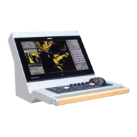
Argus Radar - SERIAL INTERFACE SPECIFICATIONS
988-10187-004 2.14
NOTE 2
Time in seconds since last SC104 type 1 or 9 update, null field when DGPS
is not used.
NOTE 3
Geoidal separation: the difference between the WGS-84 earth ellipsoid
surface and mean sea level (geoid) surface, “ – “ = mean sea level surface
below the WGS-84 ellipsoid surface.
GNS – GNSS fix data
Fix data for single or combined satellite navigation systems (GNSS). This sentence provides
fix data for GPS, GLONASS, possible future satellite systems and systems combining these.
This sentence could be used with the talker identification of GP for GPS, GL for GLONASS,
GN for GNSS combined systems, as well as future identifiers. Some fields may be null fields
for certain applications, as described below.
If a GNSS receiver is capable simultaneously of producing a position using combined
satellite systems, as well as a position using only one of the satellite systems, then separate
$GPGNS, $GLGNS, etc. sentences may be used to report the data calculated from the
individual systems.
If a GNSS receiver is set up to use more than one satellite system, but for some reason one
or more of the systems are not available, then it may continue to report the positions using
$GNGNS, and use the mode indicator to show which satellite systems are being used.
Differential reference station ID (see Note 2)
Age of differential data (see Note 2)
Geoidal separation, m (see Note 4)
Antenna altitude, m,re:mean-sea-level (geoid)
$-- GNS, hhmmss.ss, llll.ll, a, yyyyy.yy, a, c--c,xx,x.x,x.x,x.x,x.x,x.x *hh<CR><LF>
HDOP (see Note 3)
Total number of satellites in use, 00-99
Mode indicator (see Note 1)
Longitude, E/W
Latitude, N/S
UTC of position
NOTE 1
Mode Indicator. A variable length valid character field type with the first two
characters currently defined.