Using charts | 19
4 Charts
On the chart panel you can determine your vessel’s position in relation to land. You can
use the chart display for planning routes and sailing along a predefined route.
The chart function can also display your vessel’s position relative to other chart objects,
plan and navigate routes, create waypoints; overlay a radar image and display AIS
targets and weather information.
Simrad NSE comes preloaded with regional cartography.
US Versions include InsightHD Cartography for the entire US with Shaded Relief. Europe
and Rest Of World Versions include Navionics Coastal Cartography.
All Versions are compatible with Navionics Platinum Plus via SD Card.
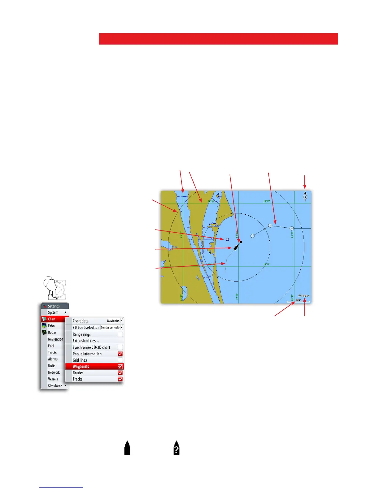
The chart panel
GRID LINES *
EXTENSION
LINE *
RANGE
RINGS *
TRACK *
ROUTE *
VESSEL
CHART RANGE RANGE
SCALE
NORTH
INDICATOR
WAYPOINT *
* Optional chart image items
You turn the optional images on/off individually.
The vessel symbol
When a GPS and a suitable compass sensor is connected to the system, the vessel
symbol indicates vessel position and heading. Without a heading sensor fitted, the vessel
icon will orientate itself using COG (Course over Ground).
If no GPS is available the vessel symbol will include a question mark.
MENU WIN
x2