Waypoints, routes and tracks | 27
5 Waypoints, routes & tracks
Waypoints
A waypoint is a mark positioned on a chart, on a radar image or on an echosounder
image. Each waypoint has an exact position with latitude and longitude coordinates. A
waypoint positioned on an echosounder image, will in addition to position information,
have a depth value.
A waypoint is used to mark a position you later may want to return to. Two or more
waypoints can also be combined to create a route.
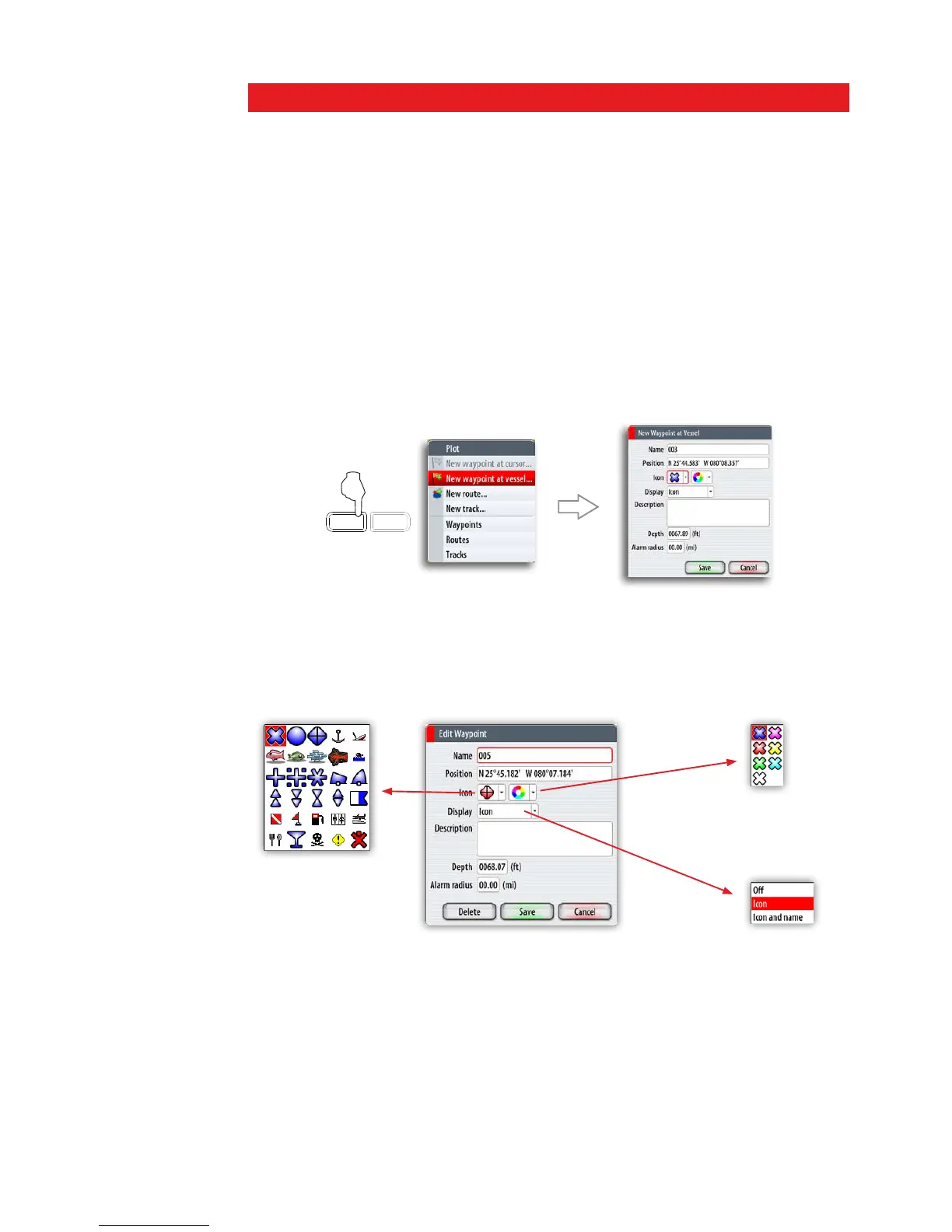
Positioning waypoints
You can position a waypoint at the vessel position from any panel by pressing the PLOT
key:
- Short press: activates the Plot menu allowing you to specify waypoint details in the
Waypoint dialog
- Press and hold: plots a waypoint at the vessel’s current position
PLOT
GO TO
MARK
VESSEL
You can position a waypoint at the cursor position on a chart, radar and echosounder
panel by moving the cursor to selected position and then pressing the PLOT key.
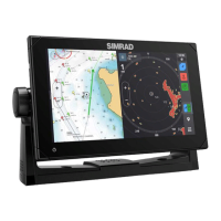
The waypoint dialogs
You can enter details for a waypoint in the waypoint dialog, activated by pressing the
rotary knob or the Tick key when a waypoint is selected.
The waypoints dialog can also be activated from the Waypoint list. Refer The
Waypoints, Route and Tracks library later in this section.