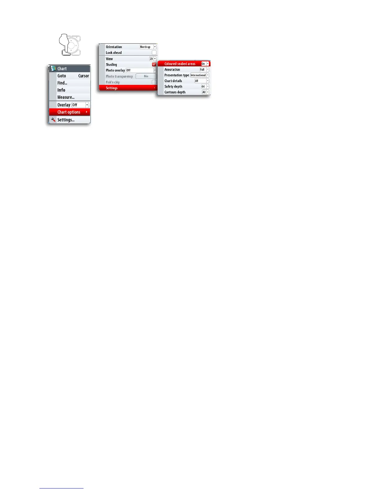
26 | Using charts
Optional settings for Navionics charts
Annotation
Determines what area information— such as names of locations and notes of areas—is
available on display.
Presentation type
Provides marine charting information such as symbols, colors of the navigation chart and
wording for either International or US presentation types.
Chart details
Provides you with different levels of geographical layer information.
Safety depth
The Navionics charts use different shades of blue to distinguish between shallow and
deep water.
The safety depth sets the limit for which depts that shall be drawn without blue shading.
Contours depth
Determines which contours you see on the chart down to the selected contour’s depth
value.
MENU WIN