Receiver Setup and Survey
HiPer+ Operator’s Manual
4-4
Step 2: Measure Antenna Height
The location of the antenna relative to the point being measured is
very important for both surveys in which the elevation of the points is
important and in surveys for horizontal location only. Horizontal
surveys are often larger in area than can reliably fit on a flat plane,
therefore the antenna adjustment must be done in three dimensions
and then projected onto a two dimensional plane.
The receiver calculates the coordinates of the antenna’s phase center.
To determine the coordinates of the station marker, the user must
specify the following:
• Measured height of the antenna above the station marker
• Method of measuring the antenna height
• Model of the antenna used
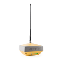
Antennas have two types of measurements:
• Vertical – measured from the marker to the antenna reference
point (ARP) located on the bottom of the receiver at the base of
the mounting threads.
• Slant – measured from the marker to the lower edge of the
antenna slant height measure mark (SHMM) located on both end
panels of the receiver.
The point to which surveying with GPS/GLONASS measures is
called the Phase Center of the antenna. This is analogous to the point
at which a distance meter measures in a prism. A user must enter the
prism offset to compensate for this point not being at a physical
surface of the prism. For a GPS/GLONASS antenna, the offset is
entered depending on the type of measurement taken.
• For vertical, the offset is simply added to the measured vertical
height to produce a “true” vertical height.
• For slant height, the vertical height must first be calculated using
the radius of the antenna, then the offset can be added.
The offsets are different because of the difference in location between
the slant measuring point and the vertical measuring point.