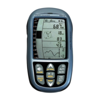
3.7 Temperature
The 6030 uses a temperature sensor, not only for compensation of the pressure sensors but also for
automatically regulating the contrast of the display. The temperature can be displayed in the user-field Temp
and can be set to Fahrenheit or Celsius in Menu>Device settings>Units. It should be noted the sensor
measures the circuit board temperature. The inside temperature of the casing can be higher than the ambient
air temperature, especially when in direct sunlight.
3.8 Time and Date
The 6030 contains a real-time clock that is periodically set to your local time by the GPS signal and can be
displayed in the user-field Time. The time does not need to be set since it is automatically set by the GPS
receiver. The UTC time will be automatically set when the 6030 acquires GPS coverage for the first time (or
after the instrument has been re-initialized) and will be confirmed with a short beep. However, to set the unit to
local time, you must enter the difference from UTC. A positive value corresponds to time zones east of
Greenwich and negative values to those west. It is also possible to enter half-hour time zones by adding a 0.5h
shift to the set time zone. The UTC offset and date can be set under Menu>Device settings >UTC offset.
3.9 Flight Time
The takeoff time is automatically recorded and the flight time starts when the 6030 detects horizontal movement
or a change of altitude. This is referred to as Flight Acceptance. Flight acceptance will occur when either the
GPS speed exceeds 10km/h or there is 20m change in altitude (within 60 seconds). These default values can
be changed in Menu>Pilot settings> Recording>Recording mode.
The flight time can be displayed in the user-field Flt Time. The 6030 will also automatically recognize the end of
the flight when horizontal movement is less than 10km/h and the vario is less than 20 ft/min for 60 sec. In
Menu>Pilot settings>Recording>Recording Mode you can choose between automatic, semi automatic and full-
time recording. For more information on recording, see Section 6.1.
3.10 Distance Measurements
3.10.1 Distance to Waypoint
The horizontal distance to a waypoint can be displayed in the user-field Dist WP. This distance will appear,
either if the instrument has switched to the waypoint automatically as part of the Route function, or if the
destination has been chosen manually with the Goto function. For distances under 10 km the resolution is 10
meters; if the distance is greater than 10 km the resolution is 0.1 km. Please read Section 5.1, Goto Function.
The distance to a waypoint is always measured to the actual waypoint and not to the cylinder that may be
around the waypoint in the case of a Competition Route.
3.10.2 Distance to Last Thermal
This function can assist the pilot in relocating thermals that are lost when searching for better lift. The user-field
Dist Therm will show the distance to your last thermal with a climb rate over a predetermined limit. The
threshold for the last thermal can be set in Menu>Pilot settings>Vario>Last Thermal threshold. A small up-arrow
in the compass rose shows the direction to the last thermal. If this arrow is displayed at the top in the ring, then
you are flying towards the thermal; conversely, if the arrow is in the bottom of the compass rose, you are going
away from the thermal.
3.10.3 Distance to Goal
The remaining distance to goal, or to the end of a route around the balance of that route, can be displayed in the
user-field Dist goal. This value is used when calculating L/D to goal (see Section 4.6 below).
3.10.4 Distance to Restricted Airspace
It is possible to enter restricted airspace (referred to as CTRs) in the 6030. CTRs will appear on the real-time
map and can be polygons, circles or polygons with arc sections. The distance to the nearest CTR can be
displayed with the user-field Dist CTR. For information on entering restricted airspace please see Sections 7
and 8.4