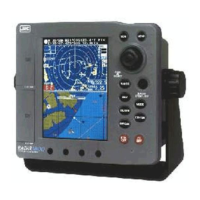
100
Section 3 Operation
MANUAL
E 0.0°
LAT/LON
MAGNETIC CORR.
RESET LOG
CALIBRATION
UNITS
FT
1.0000/m
° F
KTS/NM
DEPTH
YOUR DEPTH
TEMPERATURE
SPEED&DIST UNIT
Note:
•When you input the navigational information data from the GPS/DGPS
or the external navigation aids, you need to connect the specified signal
line to the GPS/DGPS connector or the NMEA connector on the rear
panel. In addition, after connecting the external navigation aids, be sure
to check that the NMEA0183 sentences of $xxGGA or $xxRMC are
output from the connected external navigation aids. (You can check this
easily using the self test mode of the RADAR 1800.)
NMEA OUT (Putting out data)
•In this menu, you can issue the data in the specified format.
•If you press the
Joystick
when the Radar screen is displayed in the
Radar mode and the Radar/Chart mode, the position of the cursor
($RDRSD) is output.
UNITS
•In this menu, you can select the unit of depth, temperature, speed,
and distance.
DEPTH (Selecting depth units)
•In this menu, you can select from among MT (meter), FT (feet), FM
(fathom), and SP (special). When SP is selected, the depth is displayed
with the unit you set.
YOUR DEPTH (Setting custom depth units)
•In this menu, you can specify a meter-covered value for your own
depth (SP). The unit ranges between 0.3000/m and 1.9999/m, and
you can specify it in increments of 0.1 millimeter.
TEMPERATURE (Changing temperature units)
•In this menu, you can select the unit of water temperature between
Centigrade (°C) or Fahrenheit (°F).
SPEED & DIST UNIT (Changing speed and distance units)
•In this menu, you can select a pair of speed and distance units
between KTS & NM (knots/nautical miles), KPH & KM (kilometers
per hour/kilometers), and MPH & SM (miles per hour/statute miles).
CALIBRATION
•In this menu, you can set a calibration value for each data described
below.
LAT/LON (Calibrating the longitude/latitude)
•In this menu, you can set a calibration value for the longitude and the
latitude.
 Loading...


