137
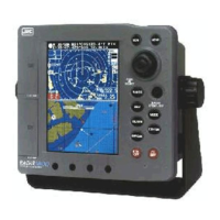
Section 9 Specification
Display method Mercator projection (Latitude 70 maximum).
Display mode Chart,CDI (Compass), DATA, Wind
(Direction/Velocity)
Chart data C-MAP card
Waypoint Number of waypoint: 1000point
Number of Icon: 24 icon
Length of waypoint name: 8 characters
Display color: 7 colors (work with icon)
Route Number of route: 40 route
Segment of route: 100 waypoint
Length of waypoint name: 8-characters
Display color: 7 colors
Port service Available
Track Display color: 7 colors
Interval: 0 - 3600sec
0.00 - 99.99NM
Memory capacity: 1000 - 8000 point
Registration route Available
Mark Display color: 7 colors
Memory capacity: 2000 - 9000 point
(including waypoint data)
Number of mark 24 (same as WPT)
Input: Cursor position/Own ship position
MOB Available
Construction Dot. Line, Rectangular
Tide graph Available
Alarm Arrival, Anchor, Off-course, Danger zone, Trip
Graph display Temperature/Depth/Speed
(When temperature data and/or depth data are
inputted.)
Plotter
 Loading...


