122
Section 5 Principle
Wide Area Augmentation System (WAAS)
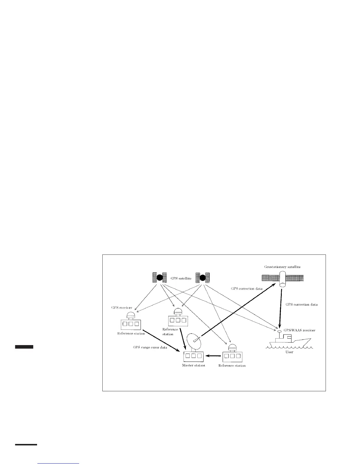
Wide Area Augmentation System (WAAS) is a system that improve GPS
position fixing accuracy. GPS signal errors are observed at multiple ground based
reference stations. The data are gathered to the master station, then correction
values are comprehensively calculated. The correction values are transmitted to a
geostationary satellite, then they are broadcasted to ground based users. Ground
based differential GPS system, similar to a beacon differential GPS, supports
300km in radius around the beacon station, but the WAAS vastly expands the
service area to mountainous and off-shore regions. The WAAS covers the Eastern
Southern and Mid-western United States with INMARSAT Atlantic ocean
region-west satellite, and covers the Western United States, Alaska and Hawaii
with INMARSAT Pacific ocean region satellite.
The WAAS service is free of charge because The WAAS is operated by the
Federal Aviation Administration that is governmental entities.
Availability of WAAS
Currently, the WAAS is doing broadcast tests. Full-scale operations of the
system is scheduled to the end of 2003. During test operations the WAAS can be
used with almost no time-lapse problems, but it causes infrequent transmission
stoppage and some degraded accuracy correction. Further, some functions of the
GPS112W may be not available for use during the test transmission period due to
system upgrades carried out to improve performance.
JRC is not liable for any loss while using the WAAS satellites during test
transmissions, or any malfunction of the GPS112W by the upgrades of WAAS
system.
WAAS System
Figure 5-8
 Loading...


