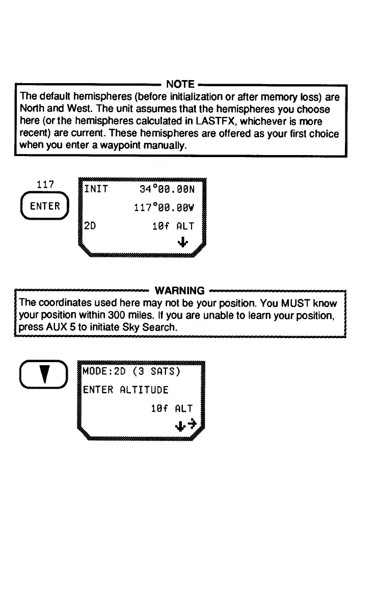
2-7
N and S, if necessary.
Press ENTER.
From the initial position
screen, press the DOWN
ARROW to go to the
mode/altitude display.
Press the RIGHT ARROW
to choose 2D, 3D, or
AUTO Modes.
Remember that in 2D the unit calculates latitude and longitude only,
and altitude is a user-entered value. In 2D, the unit is able to calculate
more accurate position fixes when an altitude is entered at the mode/
altitude display than is possible without a user-entered altitude. (Op-
eration in the 2D Mode is recommended for marine use.) In 3D,
altitude is calculated by the unit. In the Automatic Mode, the unit uses
3D when 4 satellites are visible and 2D when only 3 satellites are
visible.
Enter the longitude by
pressing the numbers on
the keypad. Use the
RIGHT ARROW to toggle
between E and W. Press
ENTER.
 Loading...