122 E-Series Networked Display Reference Manual
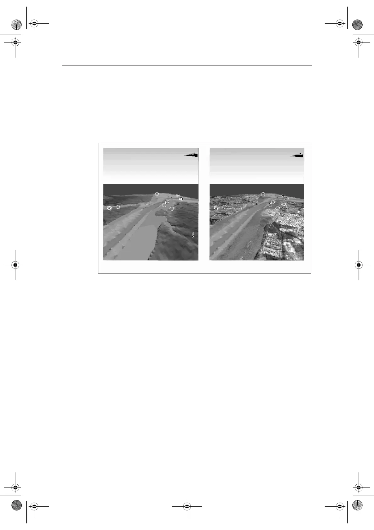
5.10 Aerial photo overlay
You can overlay an aerial photo onto the 3D image. This will help you to interpret
your environment and its features. Aerial photos cover the navigable waters up to 3
miles inside the coastline. Beyond these limits the land will appear green (color
charts) and grey (black and white charts). The level of resolution and the availability
of a colored overlay is dependent on the region covered by the chart card.
Aerial photo overlay is controlled via the 3D Chart Setup Menu. See
page 127
for
more details.
5.11 Making the view clearer
You can make the view clearer using the following features:
• Exaggeration.
•Declutter.
Exaggeration
Sometimes it is easier to see certain topographical features if they are exaggerated.
Adjusting the exaggeration has the effect of vertically stretching objects on the
chart, making it easier to see their shape and position. This could be particularly
helpful if you are fishing, for example.
Standard 3D image 3D image with aerial overlay
D8848_1
81244_4.book Page 122 Thursday, January 31, 2008 1:53 PM