Chapter 4: Using the Chart 67
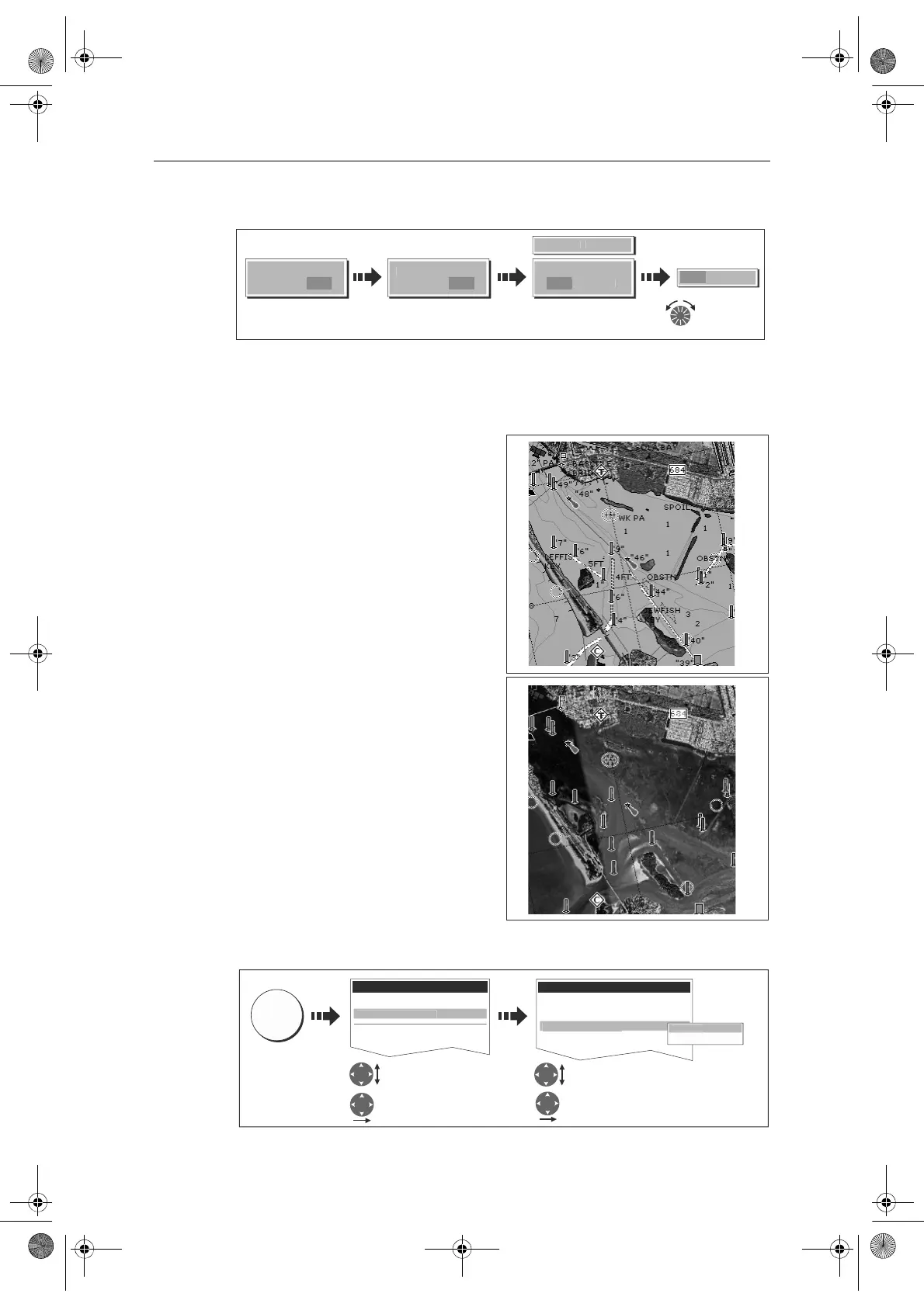
To change the level of opaqueness:
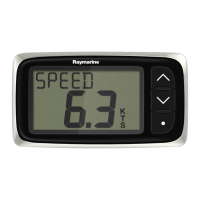
Specifying the overlay area
You can specify whether the aerial photo overlay is displayed for land areas only or for
land and sea areas.
• On Land - displays a normal chart
view for sea areas and overlays an
aerial photo on the land. This will
enable you to clearly see cartographic
detail in the area that you are cruising
whilst helping you to interpret your
surroundings by displaying land fea-
tures.
• On Land and Sea - displays an
aerial photo on both the land and sea
areas. This enables you to interpret
deeper water (dark blue) from shal-
lower (light blue) and to view land
features simultaneously.
In shallow
water, in some parts of the world
where the photos are good and
clear you will actually see bottom
features like sandbanks, reefs etc.
To specify the overlay area:
D8320-1
AERIAL
VERLA
N
FF
AERIAL
VERLA
N
F
ERIAL
VERLAY
F
N
Adjust
overlay level
as required
Overlay slider
displayed
Enable soft key
D8267_2
D8581_1
Select Cartographic
setup
Highlight Cartographic
setup
Highlight Aerial Photo overlay
Select Aerial Photo overlay
D8268_1
MENU
Setup
Chart Setup...
GPS Setup...
Carto
rap
y Setu
Cartography Setup Menu
.....
Coloured SeaBed Areas OFF
Business Services ON
Roads ON
erial Photo Overla
n L
On Land and Sea
n Lan
81244_4.book Page 67 Thursday, January 31, 2008 1:53 PM