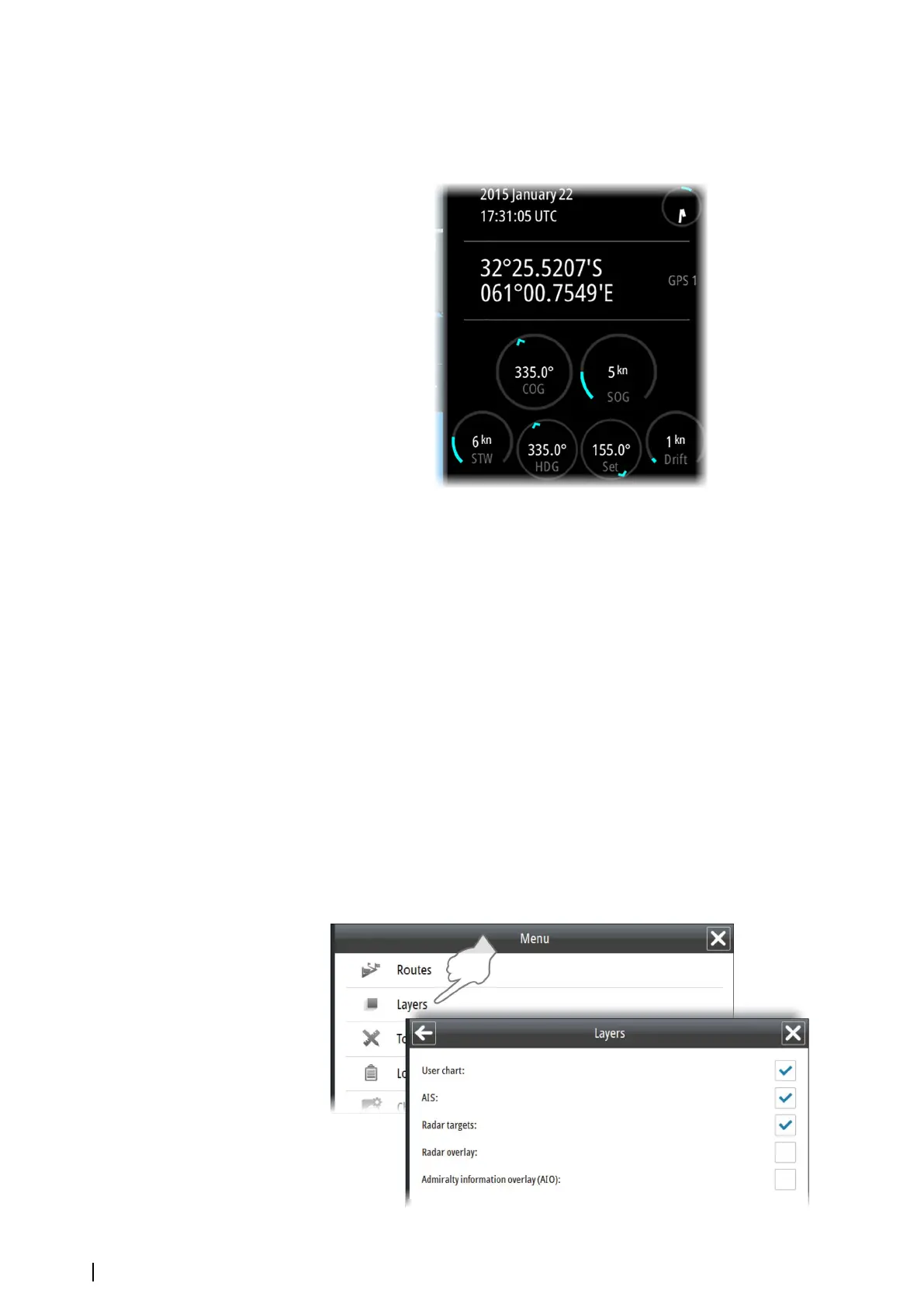
The Instrument bar
The Instrument bar includes time and position read from an EPFS (Electronic Position-Fixing
System) sensor, together with indicators for the system's main sensors.
Where multiple sensors exist, the information displayed is for the sensor with the highest
priority that is receiving data.
Valid sensors are indicated with a blue outline. Missing sensors or sensors sending invalid or
bad data have a yellow outline.
The Navigation panel
The Navigation panel is automatically activated when you start navigating a route. See
information in "Sailing along a predefined route" on page 54.
The Overview map
The Overview map makes it possible to display an overview or a detailed chart independent
of vessel position and chart scale in the main chart view.
In this panel the chart is always shown with north up.
There is no indication in the Vessel button if the vessel is not shown on the overview map.
Layers
The system organizes chart overlay information in separate layers.
You turn these layers on and off from the Layers option in the main menu.
14
The user interface | E50xx ECDIS Operator Manual