StructureMap tips
• To get a picture of taller structures (a wreck, etc.) — do not drive over it, instead, steer the
boat so the structure is on the left or right side of your vessel.
• Do not overlap history trails when conducting a side-by-side scan of an area.
Using StructureMap with mapping cards
StructureMap allows you to maintain full chart capability and can be used with preloaded
cartography as well as C-MAP, Navionics, and other third-party charting cards compatible
with the system.
When using StructureMap with mapping cards, copy the StructureMap (.smf) files to the
unit’s internal memory. We recommend keeping copies of StructureMap files on external
mapping cards.
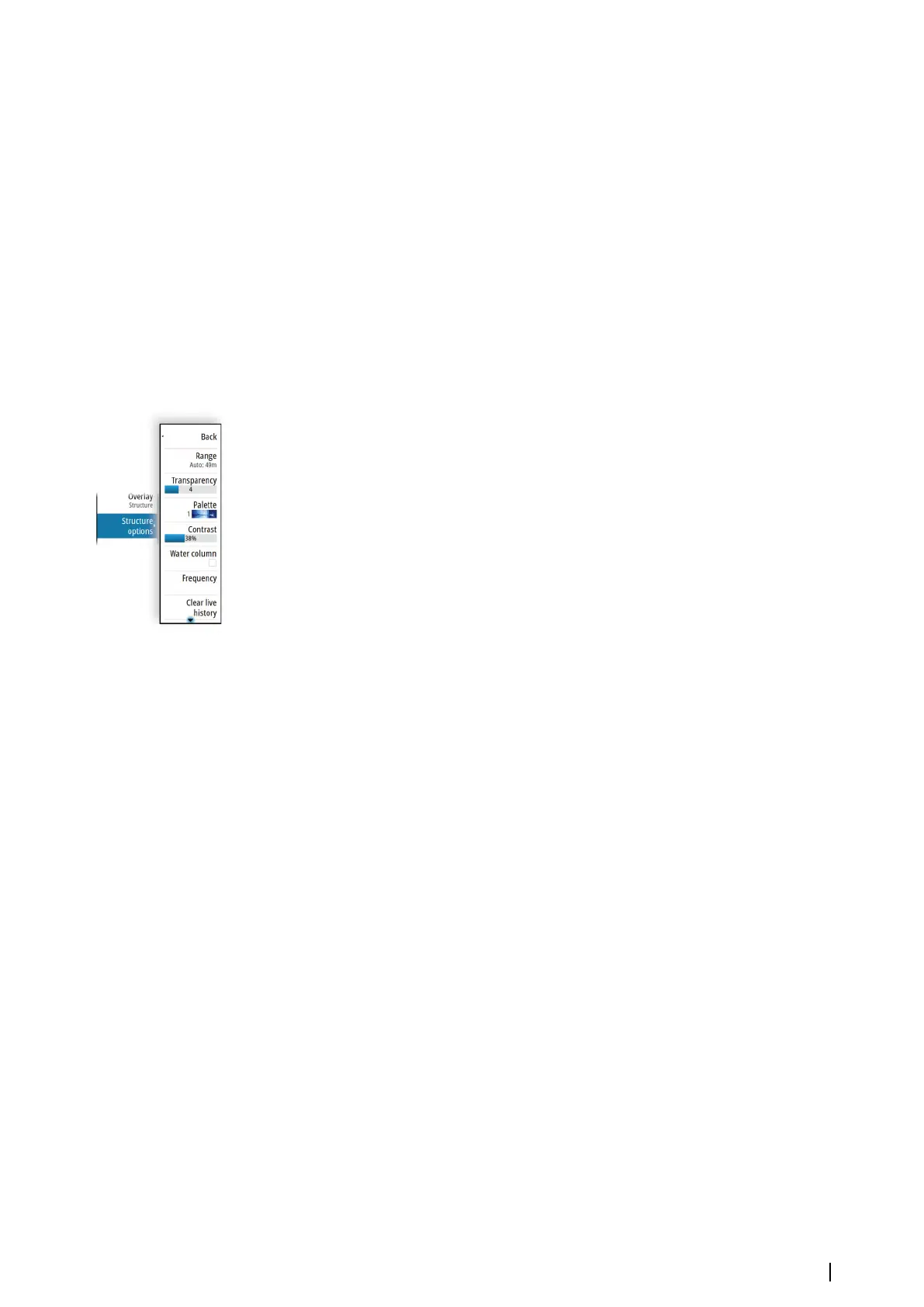
Structure options
You adjust the StructureMap settings from the Structure options menu. The menu is
available when Structure overlay is enabled.
Not all options are available when saved StructureMap files are used as the source.
Unavailable options are greyed.
Range
Sets the search range.
Transparency
Sets the opaqueness of the Structure overlay. With minimum transparency settings, the chart
details are almost hidden by the StructureMap overlay.
Palettes
Used for selecting the image's color palette.
Contrast
Determines the brightness ratio between light and dark areas of the screen.
Water column
Shows/hides the water column in Live mode.
If turned OFF schools of bait fish might not be seen on the SideScan image.
If turned ON the accuracy of the SideScan image on the map might be affected by the water
depth.
Frequencies
Two frequencies are supported. 800 kHz provides the sharpest image without sacrificing
range. While 455 kHz can be used in deeper waters, or for expanded range capabilities.
Clear live history
Clears existing live history data from the screen and begins showing only the most current
data.
Log sonar data
Displays the log sonar dialog. Refer to "Recording log data" on page 70.
Source
Determines the StructureMap source displayed on the chart overlay. Refer to "StructureMap
sources" on page 90.
StructureMap| NSS evo3S Operator Manual
91
 Loading...