Chapter 4
P/N 7010-0369 www.topconpositioning.com
4-1
Surveying
NOTICE
This section focuses on using the System Five on
the jobsite and assumes that the user is familiar
with field preparation and its fundamental
concepts.
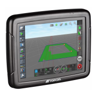
The AG System Five™ allows you to:
• survey a field to determine the existing slope.
• survey a field to calculate the average field elevation.
Overview
Surveying a field allows you to determine both the field’s average
slope and its average elevation. The slope and elevation of the field
provide information on the high and low points of the field, and
thus the cut and fill levels for those points.
When in survey mode, Topcon’s TM-1 mast moves the laser
receiver up and down until the receiver locates, locks onto, and
tracks the laser beam. If the receiver loses the beam for more than
20 seconds, the TM-1 mast automatically moves the receiver to
search for, locate, and track the beam.
To survey, the operator raises or lowers the scraper until it just
“floats” across the ground without cutting or filling. As the scraper
travels along the high and low points of the field, the mast raises or
lowers the receiver to track the laser beam. As the TM-1 moves up