Surveying
Topcon AG System Five Operator’s Manual
4-10
• If the calculated slope goes in the opposite direction as
the approximate slope in the transmitter, subtract the
two values to get the true slope of the field:
calculated perimeter survey = .05% slope north to south
.35% N–S slope in laser - .05% S–N slope = .30% N–S slope
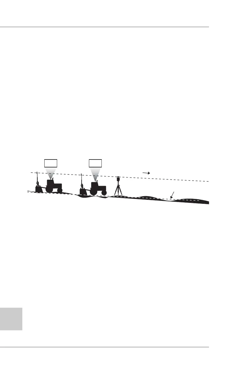
Serpentine Survey
The serpentine survey reveals the highs and lows of your field and
can be accomplished in either manual or automatic elevation
recording mode (Figure 4-9). The data collected from a serpentine
survey allows you to find the field's average elevation and to create
a cut and fill map. The cut and fill map allows you to plan your
land-leveling operation for more efficient and higher quality results.
Figure 4-9. Serpentine Survey Reveals Highs and Lows
In the serpentine survey, cross from one field border to the other
then turn around and return, continuing until you have covered the
entire field (Figure 4-10 on page 4-11). Typically, each “leg”
spacing would be 100’ to 200’ apart.
• For large, relatively smooth fields, a 200’ spacing is sufficient.
• For smaller fields, or fields with an uneven ground, a closer
spacing provides a more accurate survey.
5.80
5.40
Average Elevation
.075%