44
Section 3 Operation
N 42° 34.255'COG122.3° DGPS
W122° 19.487'SOG 25.5KTS
N 43° 17.181'
W124° 24.215'
BRG 295.8°
RNG 2426NM
SHIP POSITION
COURSE & SPEED
GPS STATUS
CURSOR
INFORMATION
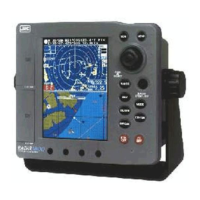
Figure 3-2 Plotter mode
Ship position is available when used with GPS/DGPS
sensors or NMEA 0183 format data is received.
COG (the ship’s course over the ground) and
SOG (the ship’s speed over the ground) appears.
DGPS : Differential GPS fix. (Beacon TYPE)
DGPS-W : Differential GPS fix (WAAS TYPE)
GPS : GPS fix
NO FIX : Fix not available or invalid
NO DATA : No position data input (No GPS/DGPS
sensor connected)
LAT/LON of the cursor, the distance between the
vessel and the cursor, the bearing of the cursor appear.
The information about the cursor can be selected whether
or not to display. (Refer to “CURSOR INFO” p.91)
No. ITEMS Displaying symbols
q SHIP POSITION
w COURSE & SPEED
e GPS STATUS
r CURSOR INFORMATION
 Loading...


