Appendices
Copyright © 2015 Coda Octopus Products Ltd
135
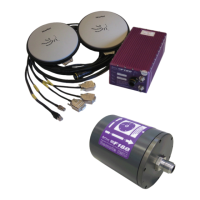
F180R MOTION Sensor User and Reference Guide
The GPS antennas supplied with the F180R System use built–in low noise amplifiers that
typically provide +23 to +26 dB of gain for the satellite signals. Signal gain of this degree will
allow the GPS Antenna to operate with suitable coaxial cables that exhibit an overall
attenuation of 14 dB or less at the GPS operating frequency. Ideally, the overall loss should be
no more than 10 dB.
The antenna cable must meet the following requirements for use with the F180R System:
RF loss at 1575 MHz.................14 dB maximum (10 dB nominal)
Impedance..............................50 ohms
DC resistance ..........................5 ohms maximum
Antenna connector ...................TNC male
Receiver connector...................TNC male
The <%PRODUCTNAME%> comes with a standard set of 15m (Novatel CO16) antenna cables
with options for 5m (Novatel C006) and 30m (Novatel C031). For vessel deployments requiring
longer cable runs, standard low-loss coaxial cables can be used with the <%PRODUCTNAME%>.
In particular, Belden 9913 and LMR400 cable types have been used for extended cable runs of
up to 45m during <%PRODUCTNAME%> deployment. The length of the cable run is limited by
the GPS signal attenuation which is limited to 14 dB maximum (10 dB nominal) measured at
1575 MHz.
The bolt dimension for the antennas is 5/8 inch by 2 inches, UNC stainless steel.
6.2
Inertial Attitude and Position System Theory
This chapter aims at giving the user a short introduction to the theory behind a satellite based
navigation system as well as a brief discussion on the benefits of combining it with an inertial
attitude sensor. Please refer to specialist textbooks for a more thorough presentation of the
concepts introduced in this chapter.
6.2.1 Global Positioning System (GPS)
The Global Positioning System (GPS) is a satellite based navigation system with a global
coverage and a high level of accuracy and repeatability. It was initially developed by the US
Department of Defense primarily to support the US military with a reliable passive method of
estimating position, velocity and time.
Throughout the 1990s, more and more civilian applications were based on the USGPS system
and it quickly became the primary source of navigation for land, sea and airborne mapping
operations. Other satellite based navigation systems have been developed parallel to the
USGPS, the most notable ones being the Russian GLONASS system and the Galileo system
which is launched by the European Union at the moment.
The F180R System is currently set up to use the USGPS navigation system and the following
background theory is relevant only to this system.