Appendices
Copyright © 2015 Coda Octopus Products Ltd
137
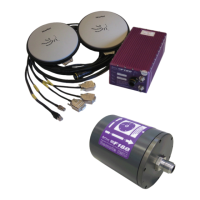
F180R MOTION Sensor User and Reference Guide
The GPS receivers onboard the F180R System unit make use of both the pseudorange
measurement model and the carrier phase measurement model. Information on what model
is in use is given by the MOTION Control software.
Positioning Methods
The original USGPS position method was Standalone Positioning where the receiver is only
dependent on the GPS satellite signals. Under optimal conditions the absolute accuracy of a
position fix generated in standalone mode will be between 5 and 10 meters depending on
receiver type and measurement model.
Differential GPS
In order to improve the accuracy of the system to a higher order of magnitude, an alternative
positioning method commonly referred to as differential GPS (dGPS) has been developed. You
can apply the technique of differential position by using two receivers: one established on a
known point (the master) and the other at the point of interest (the rover) and both receivers
tracking the same satellites. Since we already know the coordinates of the master station, the
difference between this known coordinate and the instantaneous master GPS coordinate can
be applied to the rover receiver. Any systematic errors are therefore mitigated, thus
increasing the accuracy of the receiver.
The differential information is commonly transmitted by HF radio waves or over a satellite
link. The F180R System is capable of receiving differential corrections in a variety of formats
from a set of different sources depending on the range from reference stations and accuracy
requirements.
Heading Determination
The F180R System estimates the heading of the vessel by calculating the vector between two
GPS positioning solutions. In theory, these two GPS receivers form a dGPS system with a short
baseline where at least one receiver is enabled in dual frequency mode. This makes it
possible to determine the heading to a high degree of accuracy as systematic errors such as
satellite clock error, error in satellite position and errors from propagation delays through the
ionosphere and atmosphere are mitigated and minimised. Mathematically, the heading
determination is carried out by comparing the carrier-phase measurements at the two
antennas and heading accuracy is therefore very susceptible to multipath errors.
Overall, the characteristics of a GPS based navigation system can be broken down into the
following elements:
- Absolute position updates
- High long term accuracy (no drift)
- Short settling time
- Not degraded by high altitude
- Susceptibility to loss or degradation of
signal (signal blockage, multipath, poor
satellite geometry changes in signal
propagation conditions).
- Low data rate
- High noise level