Navigation
190-02488-01 Rev. B Pilot’s Guide 3-13
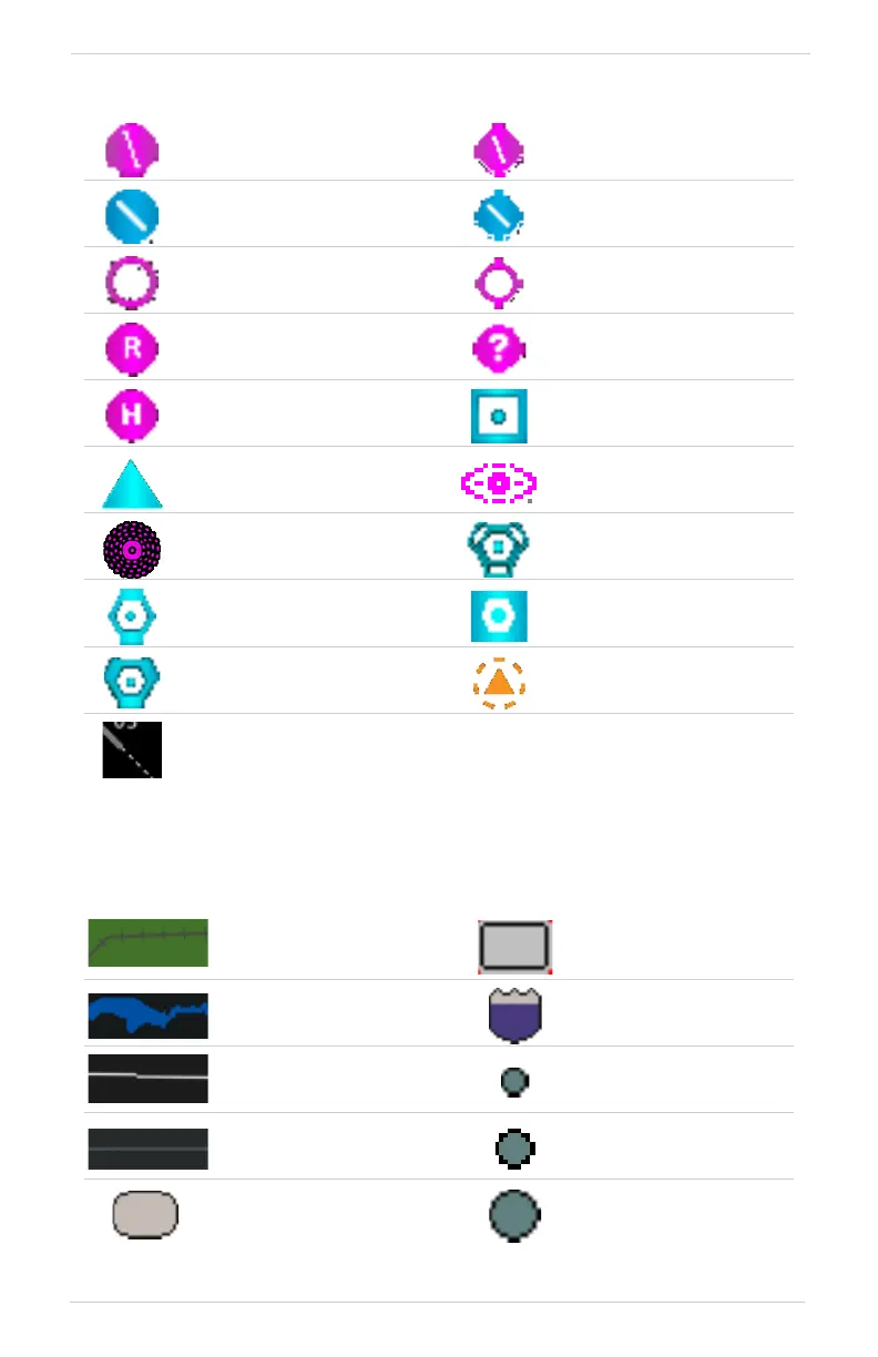
AVIATION DATA SYMBOLS
[1] Symbol depicts orientation of longest runway.
LAND DATA SYMBOLS
Non-towered,
non-serviced airport
[1]
Non-towered, serviced
airport
[1]
Towered, non-serviced
airport
[1]
Towered, serviced airport
[1]
Soft surface, non-serviced
airport
Soft surface, serviced
airport
Restricted (private) airport Unknown airport
Heliport ILS/DME or DME only
Intersection LOM
NDB TACAN
VOR VOR/DME
VORTAC VRP
Runway extension
Railroad National Highway
River/Lake Freeway
State/Province Border Small City
Local Road Medium City
Local Highway Large City



 To Next Page