USER MANUAL
INTEL® FALCON™ 8+ UAS
© 2017 Intel Corporation. All rights reserved 97
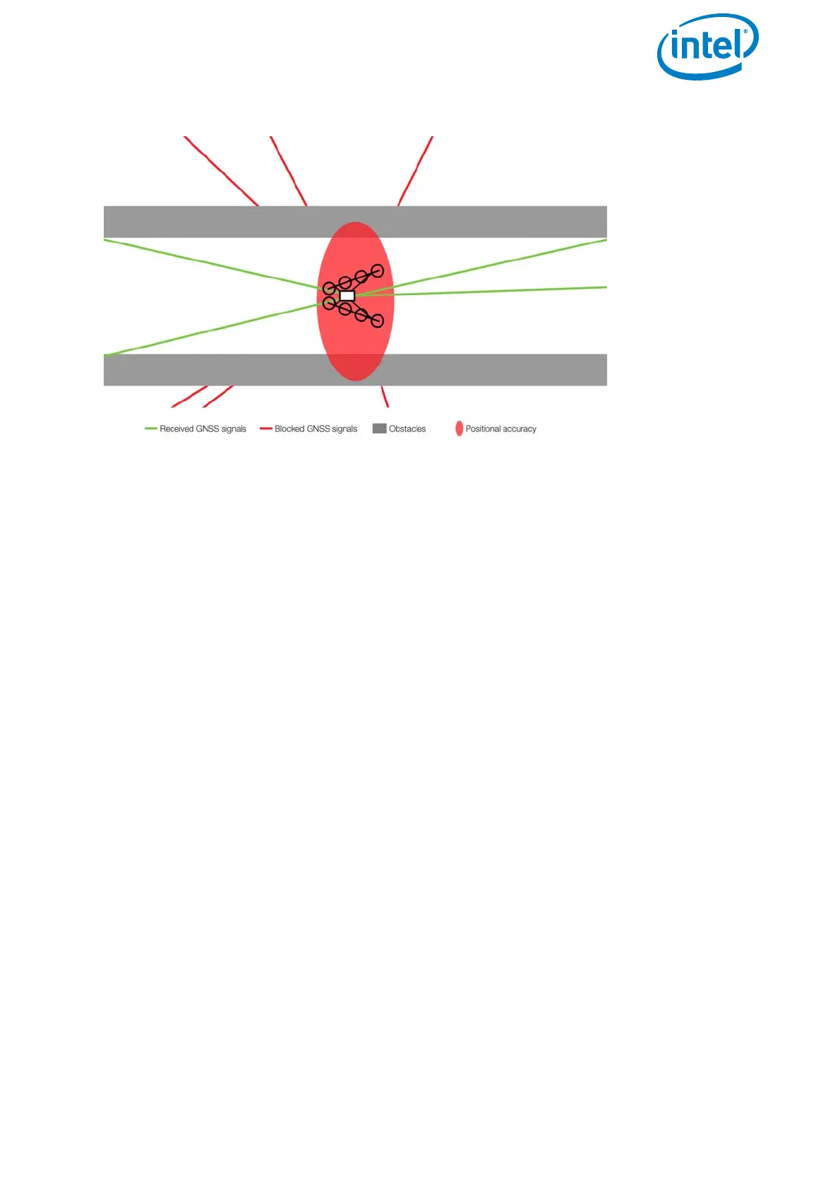
Figure 3.15: Shadowing
The position accuracy can be impaired when obstacles block the direct line-of-sight
from many satellites. The obstacle virtually casts a GNSS-shadow over the concerned
area. This results in fewer received satellite signals and a changed geometry of the
signals themselves. This effect is very common in urban areas, where satellites can be
blocked by tall buildings. You may experience one side of the street has good position
accuracy, while on the other side position accuracy is extremely poor. If the UAV moves
out of the shadow and more satellite signals can be used to calculate the position, the
UAV can suddenly change its position due to the new calculation. Therefore, the pilot
needs to pay special attention in such situations. Whenever there are potential
shadings of the GPS signal, it is recommended to not use GPS-Mode but to activate
Height-Mode on the CTR.
When the Intel® Falcon™ 8+ UAV detects a low GPS quality, it automatically activates
Height-Mode and gives the respective GPS lost warning (see “GPS Warning” on
page 126). Nevertheless, it is strongly recommended to actively switch to Height-Mode
on the CTR beforehand, because it is unpredictable when the system will switch
between flight modes. Additionally, the system might only switch to Height-Mode
when the positional accuracy already low for the current flight situation.