USER MANUAL
INTEL® FALCON™ 8+ UAS
© 2017 Intel Corporation. All rights reserved 96
CAUTION: WHEN THE GPS QUALITY IS INSUFFICIENT, HEIGHT-
MODE WILL AUTOMATICALLY BE ACTIVATED. SHORTLY BEFORE
THIS POINT, POSITIONAL ACCURACY MIGHT ALREADY BE TOO LOW
AND IT IS STRONGLY RECOMMENDED TO ACTIVELY SWITCH TO
HEIGHT-MODE IN SITUATIONS WITH INSUFFICIENT GPS QUALITY.
IF THE SYSTEM AUTOMATICALLY SWITCHES FROM GPS-MODE TO
HEIGHT-MODE, THE GPS-MODE BUTTON WILL BE FLASHING, WHILE
THE HEIGHT-MODE BUTTON WILL BE LIT PERMANENTLY. THIS
INDICATES THAT THE SYSTEM WILL SWITCH BACK TO GPS-MODE
AUTOMATICALLY, WHEN A VALID GPS SIGNAL WILL BE RECEIVED.
IF THE SYSTEM SEEMS TO BE UNSTABLE OR HAS DIFFICULTIES TO
KEEP ITS CURRENT POSITION IN GPS-MODE, IMMEDIATELY
ACTIVATE HEIGHT-MODE. BE PREPARED THAT YOU NOW NEED TO
CONTROL THE POSITION MANUALLY ON THE CTR.
Figure 3.14: GPS Accuracy
The GPS module of the Intel® Falcon™ 8+ UAV supports GPS and GLONASS. Under
ideal conditions, the horizontal accuracy can reach around +/- 2 m. The short-term
accuracy is usually higher, because of the data fusion with other available sensor
outputs from the IMU. Vertical accuracy of GPS is lower and the measured altitude
can vary up to 15 m depending on satellite constellation. A barometric measurement
is used for altitude instead of relying on GPS. Height is always measured above
ground level and is reset to zero when the rotors are being started. Throughout the
duration of a mission there can be a drift of +/- 5 m due to all possible errors: tem-
perature, drift, weather changes, etc.
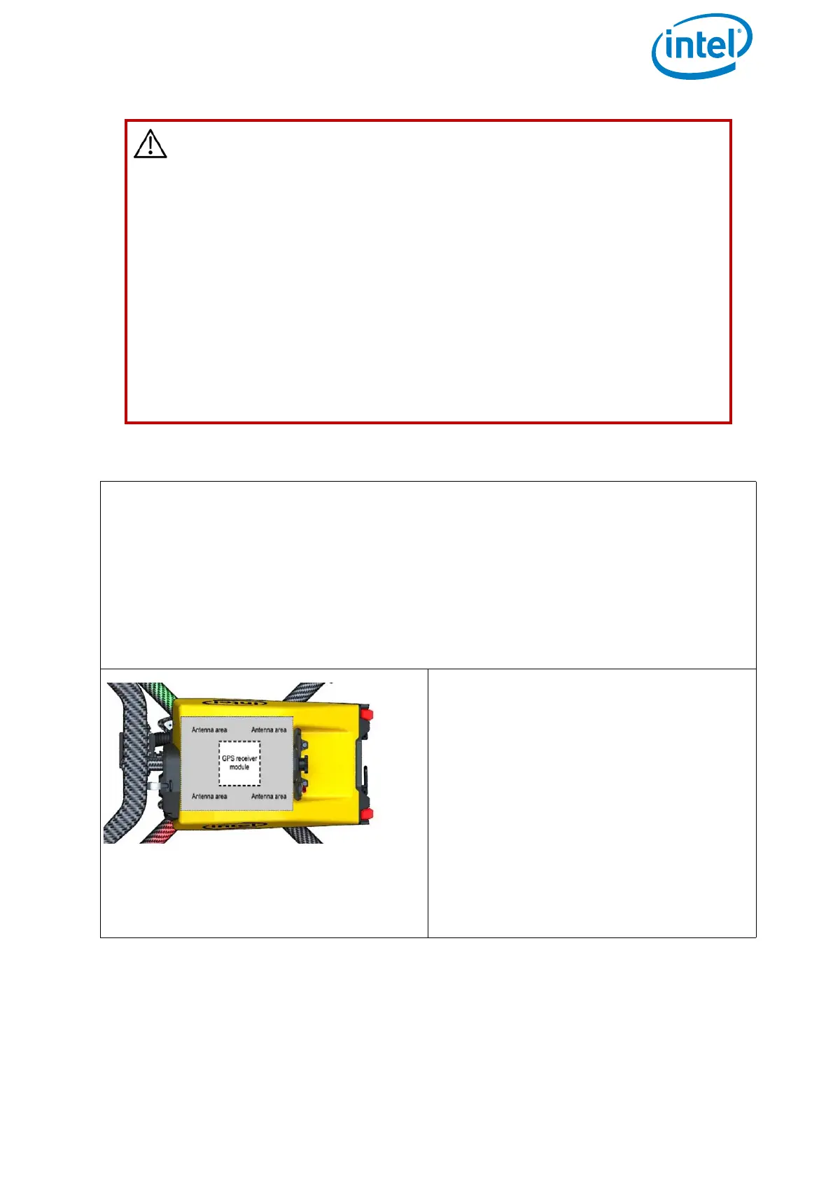
IMPORTANT:
The GPS receiver module of the Intel®
Falcon™ 8+ UAV is placed directly
underneath the canopy of the central
unit and is surrounded by an antenna.
The canopy of the Intel® Falcon™ 8+
UAV is made from a material which
does not influence the satellite signals,
but anything on the top of the Intel®
Falcon™ 8+ UAV can potentially disturb
the signal. Never cover the GPS receiver
module nor the antenna area to ensure
best possible GPS reception.