53
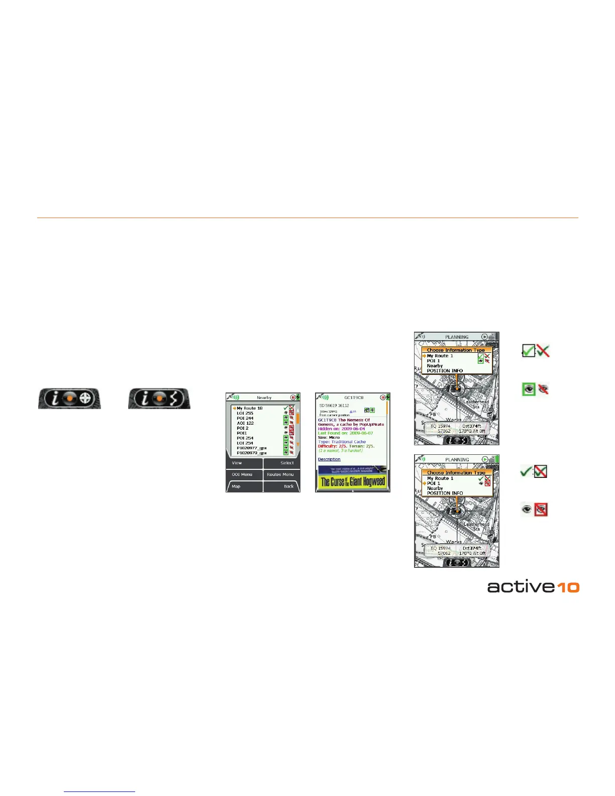
11.00 Choose Information Type
11.00 Choose Information Type Window
(GPS MAP → Choose Information Type via
center press)
Alternative access:
(PLANNING → Choose Information Type via
center press)
This window can be accessed via the GPS
MAP or PLANNING screen, by center
pressing the joystick on a route or OOI. When
the locator circle is over an OOI or a route, an
indicator icon is displayed at the bottom of the
screen. It comprises of 3 elements:
• 'i' for information
• joystick image (in the center)
• POI icon/route symbol
Active route
Visible OOI
Invisible OOI
Inactive route
OOI indicator icon Route indicator icon
Nearby routes
& OOIs
OOI details
Once you are in the Choose Information
Type window, you will be able to:
• Make OOIs visible and invisible (move the
joystick left/right to highlight relevant icon).
• Activate and deactivate routes (change time
varies depending on the size of the route).
• Center press the joystick to view details of
an OOI.
• Go to the ROUTE MAP screen of any route
(section 8.03, shows your route on a map,
with details such as trip length, and gives
you access to the Prole screen).
• Access the Nearby option, which includes
nearby routes and OOIs.
To bring up the Choose Information Type
window:
On the GPS MAP screen: your current location
has to coincide with a route or OOI.
On the PLANNING screen: planning icon has
to be placed over any point on a route or OOI.
(Otherwise, center pressing the joystick will
bring up the POSITION INFO screen, section
10.00).
By center pressing the joystick on a route or
OOI, the screen turns gray and an overlay
shows the Choose Information Type window.
To cancel the gray screen, press either of the
front buttons.
'Nearby' is dened by an OOI reference point
at a radius of:
245m (804ft) at 1:50 000
122.5m (402ft) at 1:25 000
49m (160ft) at 1:10 000
A route is classied as being 'nearby' if any of
the three conditions are true:
• The cursor is within it's bounding area (a
square or rectangle which covers ALL the
points in a route).
• The centre of the bounding area is nearby as
dened above for OOI reference points.
• The start point of the route is nearby as
dened above for OOI reference points.