67
16.03 OOI Menu: LOI Details
16.03 LOI Details Screen
(GPS MAP → MAIN MENU → OOI Menu →
OOI Folders → Select LOI → Show Details)
Alternative access:
(GPS MAP/PLANNING → click on LOI →
Choose Information Type → select LOI via
center press → LOI details)
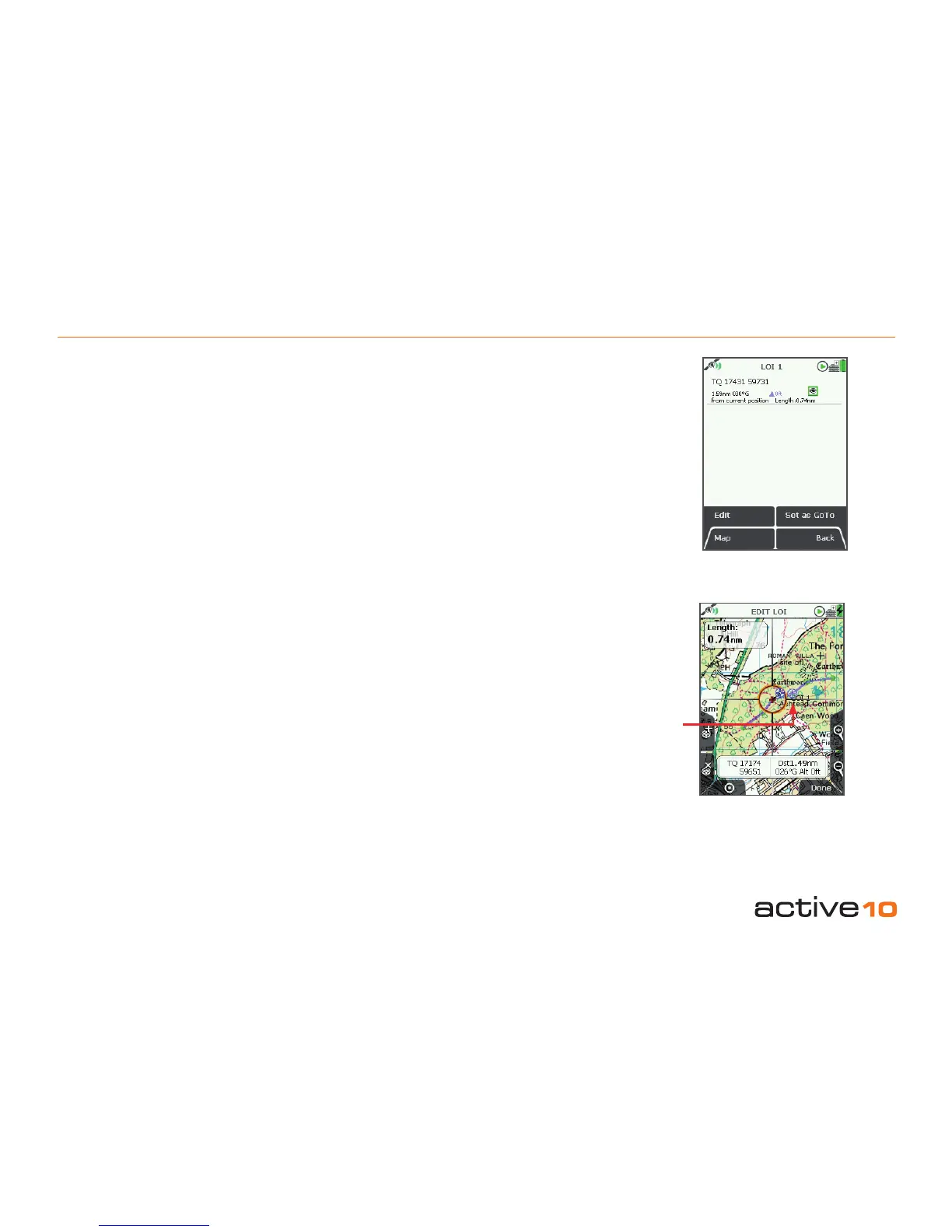
This screen summarises details of the LOI
and is titled by the current LOI name. LOIs
are date and time ‘stamped’, and the following
information is given:
• Name of the LOI
• Grid reference*
• Distance and bearing from current location*
• Length of the line
• Elevation*
• Description of LOI
Refers to the arbitrary reference point in an
LOI (usually close to the center).
The highlighted green 'eye' icon indicates the
LOI is visible on the map. When invisible, the
'eye' icon is highlighted in red with a red line
through it (section 11.00).
Figure 16.03
*
LOI
reference point
(default icon and
AOI name)
LOI reference point
(Used for grid reference, elevation, and
distance and bearing from current location on
LOI details screen).
This is the arbitrary reference point in an
LOI indicated by a default icon (visible when
editing the LOI on the map) and LOI name.
(Icon cannot be changed, but the name is
editable). It is also used as a reference point
in the following instances:
• As a GoTo point
• As a ‘POI’ in data boxes
• When using the Pointer
• When using the Center on Map button
This reference point can be moved to any
new location by using the Edit Location by
Map option.