Serpentine Survey
P/N 7010-0369 www.topconpositioning.com
4-13
• Level a small section of the field, 50’x50’, to finish grade.
• Use a grade rod to setup a benchmark hub.
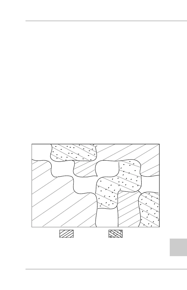
If you created a survey map, create a cut/fill map to aid in land-
leveling. First, lower the average elevation to allow for soil
compaction; the level of adjustment required depends on the
condition of the soil in the field.
For example, if the ground was tight during the survey, lower grade
from 0.02' to 0.05'. For loose ground, like after disking, allow 0.05'
to 0.10' (see Chapter 5 for more information).
In the following example (Figure 4-12), the average elevation is
5.58’. Adjusted for soil compaction of .03’, the adjusted average
elevation becomes 5.55’. Looking at the cut/fill map:
• anything above 5.55 will be a cut, and
• anything below 5.55’ will be a fill.
Figure 4-12. Cut/fill Map
N
o
r
t
h
C
u
t
F
ill
5
.
55
5
.
55
5
.
55
5
.
55
5
.
55
5
.
55
5
.
60
5
.
60
5
.
60
5
.
60
5
.
60
5
.
60
5
.
60
5
.
65
5
.
65
5
.
65
5
.
65
5
.
65
5
.
65
5
.
70
5
.
70
5
.
70
5
.
45
5
.
45
5
.
45
5
.
45
5
.
50
5
.
50
5
.
50
5
.
50