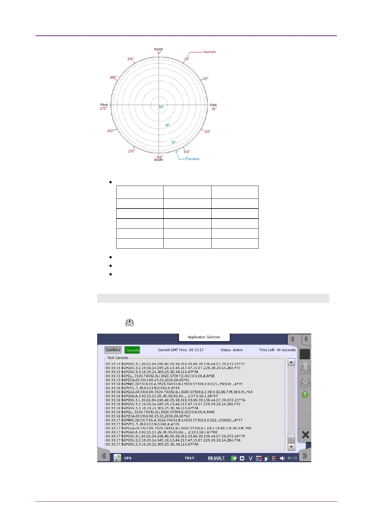
Sky ViewSky View
SatellitesSatellites
Text ConsoleText Console
Radius of the circle
corresponds to the
elevation. The
position at circle edge
is where the elevation
is 0 degree.
Clockwise angle
corresponds to the
azimuth. Top of the
circle corresponds to
north.
Data of the received satellites are displayed.
PRN: Displays the satellite number. (Pseudo-Random Noise sequences)
Satellite TypeSatellite Type
IdentificationIdentification
CharacterCharacter
ExampleExample
GPS G G23
GLONASS R R68
Galileo E E12
BeiDou B B18
QZSS Q Q04
Elev: Elevation
Azim: Azimuth
SNR: Signal to Noise Ratio
Depending on the SNR value, the text color varies in green, blue, or red.
ConsoleConsole
The logged data in text data are displayed. You can save the logged data by
touching icon on the Application Toolbar.
The log data format follows NMEA 0183 rev4.0 that is widely used in the GPS
technology.