Map Page
Envision EX5000 -18- 600-00151-001 Rev 01
highest displayed terrain. Terrain data is not displayed when your
aircraft’s latitude is greater than 75 degrees (north or south).
6) Obstacles—The EX5000’s database contains towers and other
obstacles greater than 200 feet AGL. Obstacles can be displayed
with MSL altitude label.
7) Compass Rose/Range Ring—Displays a 360-degree or 120-
degree compass circle or arc and also indicates current range
setting. The range number is the distance from the airplane
symbol to the compass arc.
!
The displayed terrain and obstacle indicators are only
advisory. It is dangerous to rely on the EX5000 as the sole
source of obstacle and terrain avoidance information. Always
refer to current aeronautical charts for appropriate terrain and
obstacle information.
Note: For example, a 2000 foot tall TV tower located in Denver (elevation
5300 feet MSL) will be depicted as being at 7300 feet MSL.
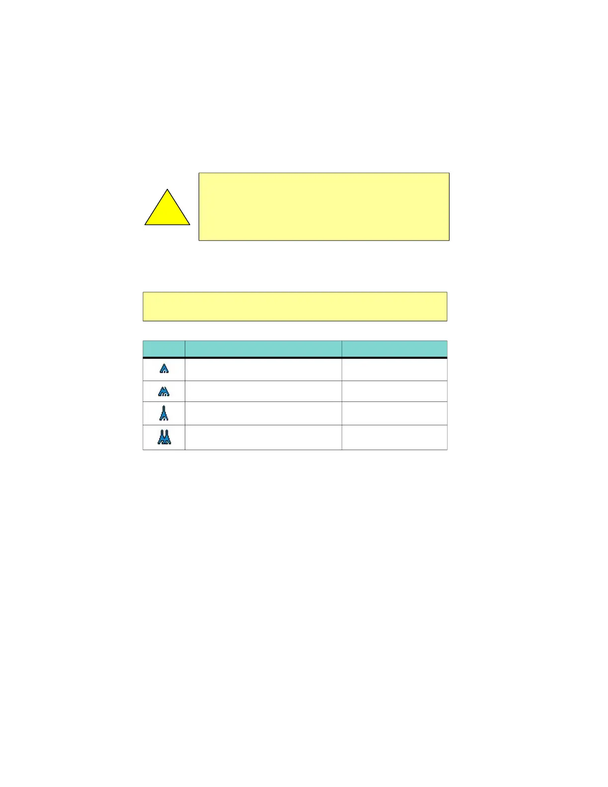
Table 2.3 Obstacle
Graphic Meaning Height (AGL)
Single Obstacle 200’ AGL to < 1000’ AGL
Obstacles within 1NM of each other 200’ AGL to < 1000’ AGL
Single Obstacle 1000’ AGL or higher
Obstacles within 1NM of each other 1000’ AGL or higher