22
1.11 How to Operate Nyon
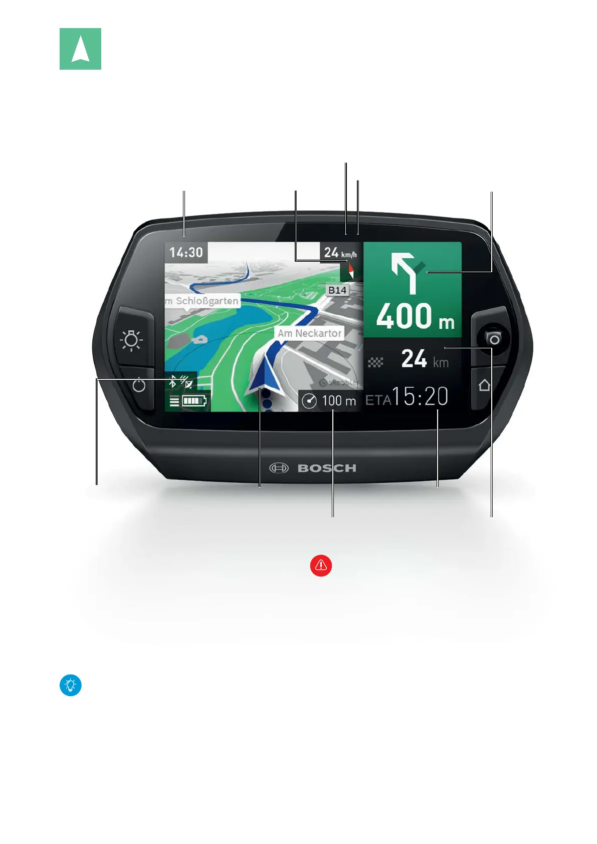
"Map & Navigation" operating mode
Clock
Shift recommendationCompass needle
(red = north)
Radius of the surrounding area
Current
location
Estimated time of arrival at
destination
Distance to destination
Speed
Turn instructions and distance
to next turn
GPS reception
Prerequisites for usage
X Map material available (see p. 23 and p. 33).
X GPS reception available:
– After switching on, Nyon searches for GPS
satellites.
– This may take slightly longer in adverse weather
conditions or unfavorable locations.
– The current location is displayed as soon as the
minimum number of satellites is found.
GPS positioning is faster if Nyon is paired with a
smartphone with an activated Internet connec-
tion during the satellite search.
Safety Instructions
– Do not use in safety-critical situations (e.g.
road closures, construction sites, detours,
etc.). Do not disregard traffic signs even if the
navigation specifies a certain way. The naviga-
tion system can not take into account con-
struction sites or temporary detours.
– Do not plan routes while riding.
– Abort the route if the navigation suggests a
route that is risky in respect to the ability of
the rider. Seek an alternative route.
– Always have additional maps or smartphone
with you.
– Nyon is not suited for navigation without a
bicycle (ex.: pedestrian travel or driving a car).







 To Next Page