Sometimesitiseasiertoseecertaintopographicalfeaturesifthey
areexaggerated.Adjustingtheexaggerationhastheeffectof
verticallystretchingobjectsonthechart,makingiteasiertosee
theirshapeandposition.Thiscouldbeparticularlyhelpfulifyou
areshing,forexample.
Adjustingthe3Dchartexaggeration
Inthe3Dchartapplication:
1.PressthePRESENTATIONsoftkey.
2.Pressthe3DVIEWOPTIONSsoftkey.
3.PresstheADJUSTEXAGGERATIONsoftkey.
4.Usingthetrackpad,selecttherequiredamountofexaggeration.
5.PresstheOKbutton.
3Dchartdecluttering
Youcandeclutterthe3Dcharttoreducetheamountofobjects
anddetailshown.
Navigatinginanareathatshowsalotofinformationonthechart,
suchasnavigationmarks,canbeconfusing.Dependingonyour
chartviewlevelitcanmakefeaturesorevenyourpositiondifcult
tosee.Declutterhelpsyoutoreducethisconfusionandmakethe
chartclearer,byremovingsomeobjectsfromview.
Declutteringthe3Dchart
Inthe3Dchartapplication:
1.PressthePRESENTATIONsoftkey.
2.PresstheDECLUTTERsoftkeyuntiltheONorOFFoptionis
selected,asappropriate.
3.PresstheOKbutton.
Aerialphotooverlayon3Dchart
Youcanoverlayanaerialphotographonthe3Dchartdisplayto
helpyouinterpretyoursurroundings.
Aerialphotoscoverthenavigablewatersupto3milesinsidethe
coastline.Beyondtheselimitsthelandwillappeargreen(color
charts)andgrey(blackandwhitecharts).Thelevelofresolution
andtheavailabilityofacoloredoverlayisdependentontheregion
coveredbythechartcard.
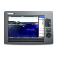
Thefollowingimagesshowthedifferencebetweenthestandard3D
chartdisplay,andthe3Dchartdisplaywithaerialphotooverlay:
Overlayinganaerialphotoonthe3Dchart
Inthe3Dchartapplication:
1.PresstheMENUbutton.
2.Usingthetrackpad,selectthe3DChartSetupmenuitem,then
pressthetrackpadrighttoselectit.
3.Usingthetrackpad,selecttheAerialPhotoOverlaymenuitem.
Usingthe3Dchart
91
 Loading...


