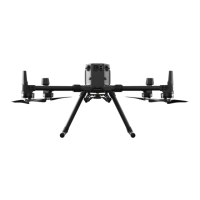
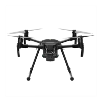
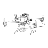
MATRICE 350 RTK
User Manual
©
2023 DJI All Rights Reserved.
25
Center of Gravity Calibration
The center of gravity will shift when the aircraft’s payloads change. To ensure stable ight, it is
required to recalibrate the aircraft’s center of gravity when a new payload is installed.
• Calibrate in a windless environment. Make sure that the aircraft is hovering and there
is a strong GNSS signal during calibration.
• Maintain visual line of sight of the aircraft and pay attention to ight safety.
Calibration instructions: Go to Flight Controller Settings in the app, and tap Calibrate in the
Center of Gravity Auto Calibration section. The Aircraft Status Indicators will glow solid purple
during calibration. There will be a prompt in the app after calibration is completed.
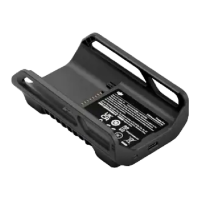
Flight Recorder
Flight data is automatically recorded to the internal storage of the aircraft. You can connect the
aircraft to a computer via the USB port and export this data via DJI Assistant 2 or DJI Pilot 2 app.
Flight Restrictions and Unlocking
GEO (Geospatial Environment Online) System
DJI’s Geospatial Environment Online (GEO) system is a global information system that provides
real-time information on ight safety and restriction updates and prevents UAVs from ying
in restricted airspace. Under exceptional circumstances, restricted areas can be unlocked to
allow ights in. Prior to that, the user must submit an unlocking request based on the current
restriction level in the intended ight area. The GEO system may not fully comply with local laws
and regulations. Users shall be responsible for their own ight safety and must consult with the
local authorities on the relevant legal and regulatory requirements before requesting to unlock
a ight in a restricted area.
GEO Zones
DJI’s GEO system designates safe flight locations, provides risk levels and safety notices for
individual ights, and oers information on restricted airspace. All restricted ight areas are
referred to as GEO Zones, which are further divided into Restricted Zones, Authorization Zones,
Warning Zones, Enhanced Warning Zones, and Altitude Zones. Users can view such information
in real time in DJI Pilot 2. GEO Zones are specific flight areas, including but not limited to
airports, large event venues, locations where public emergencies have occurred (such as forest
res), nuclear power plants, prisons, government properties, and military facilities. By default,
the GEO system limits takeos and ights in zones that may cause safety or security concerns.
A GEO Zone map that contains comprehensive information on GEO Zones around the globe is
available on the ocial DJI website: https://y-safe.dji.com.
 Loading...