4 GPSMAP
®
700 Series Owner’s Manual
Charts and 3D Chart Views
Charts and 3D Chart Views
The GPSMAP 700 series chartplotters have a basic imagery map. The charts and 3D chart views
listed below are available on the chartplotter.
NOTE
: The Fishing chart, Mariner’s Eye 3D, and Fish Eye 3D are available with a preprogrammed
BlueChart g2 Vision data card (page 17).
Navigation Chart—shows navigation data available on your pre-loaded maps and from
supplemental maps, if available. The data includes buoys, lights, cables, depth soundings,
marinas, and tide stations in an overhead view (page 4).
Perspective 3D—shows a view from above and behind your boat for a visual navigation aid
(page 16).
Mariner’s Eye 3D—shows a detailed, three-dimensional view from above and behind the boat
for a visual navigation aid (page 18).
Fishing Chart—removes navigational data from the chart and enhances bottom contours for
depth recognition (page 20).
Fish Eye 3D—provides an underwater view that visually represents the sea oor according to the
chart information (page 20).
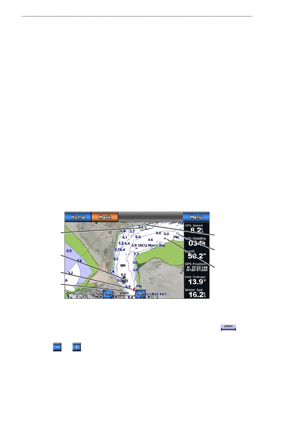
Navigation Chart
Use the Navigation chart to plan your course, to view map information, and as a navigational aid.
From the Home screen, select Charts > Navigation Chart.
Navigation Chart with BlueChart g2 Vision Data
Buoy
Marine
services
Your boat
Light
Zoom Scale
Exposed
wreck
Submerged
wreck
Zooming In and Out on the Map
The zoom level is indicated by the scale number at the bottom of the Navigation chart ( ). The
bar under the scale number represents that distance on the map.
Select the and buttons to zoom out and zoom in.
Changing from One Chart to a Different Chart
1. From the Home screen, select Charts.
2. Select a chart or a 3D chart view.
3. Select
Menu > Change Chart.
4. Select a different chart.
•
•
•
•
•