14-1
P/N: 1023998-01
Glossary
B
BDS—BeiDou Navigation Satellite System maintained and operated by China. See also, BeiDou.
Base Station—A GNSS receiver set up over a known point, which is used to derive correction
information for nearby Rover (mobile) GNSS receivers.
BeiDou—Navigation Satellite System maintained and operated by China. See also, BDS.
Bluetooth
®
—Often used in place of cables, Bluetooth is open wireless technology for exchanging data
over short distances from fixed and/or mobile devices.
E
Ephemeris Data—A table or data file showing the calculated positions of a celestial object.
G
GALILEO—The satellite system currently maintained and operated by the European Union (EU) and
European Space Agency (ESA).
GGD—GPS + GLONASS Dual Frequency signal tracking.
GNSS—Global Navigation Satellite System.
GNSS Receiver—GNSS Receivers determine the user position, velocity, and precise time by processing
broadcasted signals from global satellites.
GLONASS—The GLObal NAvigation Satellite System maintained and operated by the Russian
Federation.
GPS—The Global Positioning System maintained and operated by the United States Department of
Defense.
L
L1—The primary L-band carrier used by GPS, GLONASS and QZSS satellites to transmit satellite data.
L2—The secondary L-band carrier used by GPS, GLONASS and QZSS satellites to transmit satellite data.
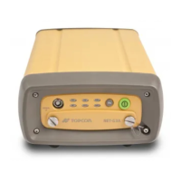
Light Emitting Diodes (LEDs)—These LEDs are used as indicator lights on the HiPer VR receiver to
display the status of the receiver’s components and to control receiver operations.
M
MAGNET
®
Field—Field application software used to collect survey mapping data for use by total
stations, levels and GNSS receivers.
MAGNET
®
Office—Post-processing and CAD solution software for surveying and grade application. It
is part of the MAGNET software system.
MINTER—The receiver’s Minimum INTERface used to display and control data input and output.