Map Symbols
600-00078-001 Rev 05 -143- Avidyne EX500/EX600 MFD
11.9 Map Symbols
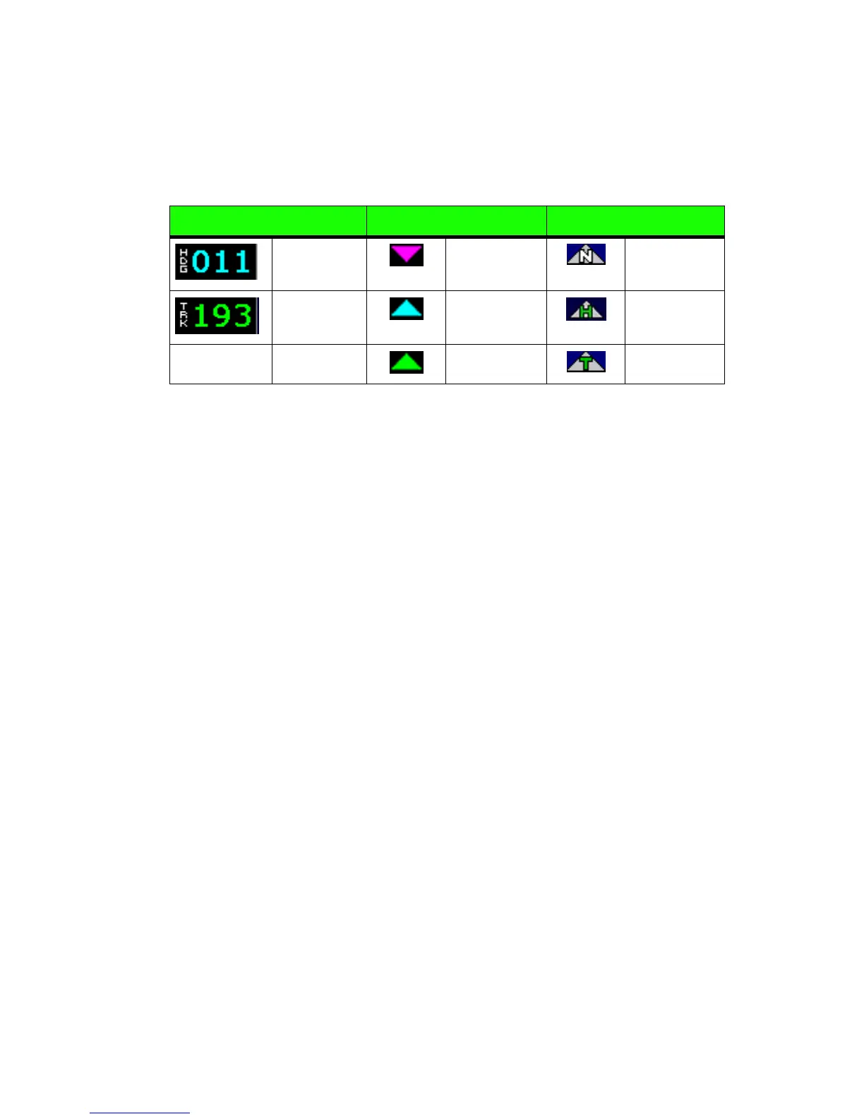
11.9.1 Heading, Track, and Map Orientation
The Heading/Track (H/T) Block provides digital readout of the current
heading, or actual track. Three triangles around the compass range
ring provide actual track, desired track, and heading indications. The
Map orientation is indicated in the triangle to the right of the H/T
Block.
11.9.2 Map Symbols—Navigational Fixes
The EX500/EX600 can display the following database items:
● Airports
● Navaids (VORs, NDBs and Waypoints)
● Airways (Victor and jet)
● Intersections, waypoints and other named fixes
● Class B and Class C controlled airspace
● Tower Zone (Class D) Airspace
● Obstacles (>200’ AGL)
● Certain classes of special use airspace (Prohibited, Restricted,
Warning, Alert and Military Operating Areas)
Table 11.4 Track Indicator Graphics
Heading Track Map Orientation
Heading Desired
Track
North Up
Track Heading Heading Up
Actual Track Track Up