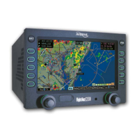
Map Page
Avidyne EX500/EX600 MFD -10- 600-00078-001 Rev 05
■ Clear Strikes - Clears all lightning-sensor-generated
lightning strikes from the display. New lightning strikes are
more visible. Clear Strikes does not remove Datalink
lightning.
■ Traffic - Selects the altitude range of the displayed traffic
from the traffic sensor. See your traffic sensor user's manual
for details of available modes.
2) Map Functions - Controls the “look and feel” of the map,
including orientation, number of elements, and base map.
■ View - Changes the map orientation. Press View to cycle
between the following:
◆ Forward - 120° view with airplane’s present position
displayed at the bottom. Current heading (or track) is
displayed at the top of the map.
◆ Center - 360° view with airplane’s present position
displayed at the center of the compass range ring with
current heading (or track) at the top of map.
◆ North up - 360° view with airplane’s present position
displayed at the center, and north is always at the top of
the map.
■ Declutter - Controls the density of symbols and labels
displayed on the map, from highest to lowest, based on
settings defined on the Declutter Setup page. See Declutter
Setup on page 86 for additional information on customizing
the declutter settings.
■ BaseMap - Controls the base map background. Press this
key to cycle through the following display options:
◆ Terrain -Terrain data background with water and geo-
political boundaries.
◆ Base - Black background with water and geo-political
boundaries.
◆ None - Black background. Terrain scale is removed.
➡➡➡