9.6 Area
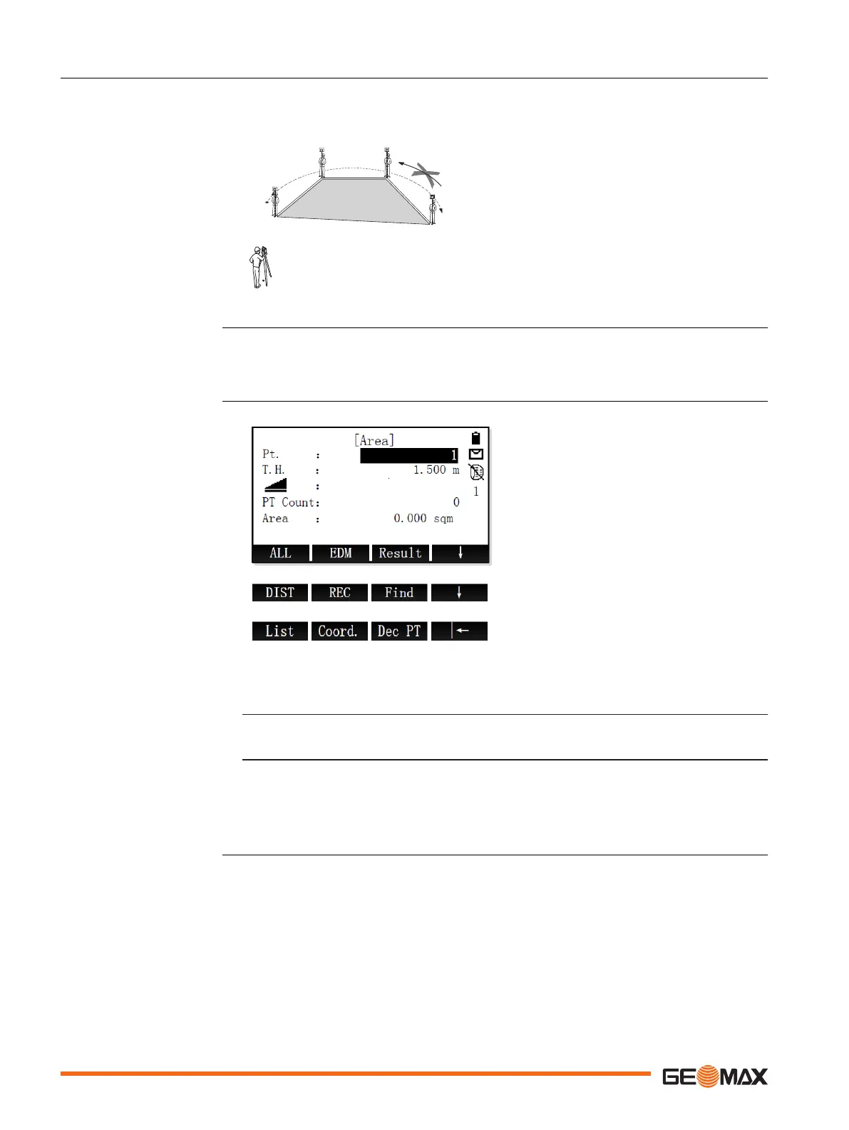
Area is an application used to calculate polygonal areas to a maximum of 20 points connected by
straights. The target points have to be measured, selected from memory, or entered manually in
a clockwise direction. The calculated area is projected onto the horizontal plane (2D).
P0 Instrument station
P1 Start point
P2-4 Target points
a Perimeter, polygonal length from start point
to the current measured point.
b Calculated area always closed to the start
point P1, projected onto the horizontal
plane.
1. Select Program (2) from the Main Menu.
2. Press the PAGE key to display screen 2. Select Area (5) from the Program menu.
3. Complete application pre-settings. Refer to "8 Applications - Getting Started".
4. Select Start to open the application.
Result To display the result screen.
Dec PT To delete the last measured tar-
get point.
1. Enter a point ID. Aim at the first target point.
To start measuring and save the measured values, press ALL or DIST+REC.
☞
Alternatively, select a target point from memory or enter the point coordinates man-
ually.
Use either Find, List or Coord..
2. Measure as many additional target points as desired, at minimum 3 points.
Next step
To display the area result screen, press Result.
Description
Access
Measure target points
60 Application

 Loading...


