"Vert. curve list" screen
•
To select a point, press the UP/DOWN keys.
•
To view details of the selected point, press View.
-
To return to the "Vert. curve list" screen, press the ESC key.
-
To edit the data of the selected point, press Edit.
-
To view details of the previous point, press PREV.
-
To view details of the next point, press NEXT.
•
To delete a selected point, press Delete.
A start point cannot be deleted.
Next step
To save the entered road data and return to the road menu, press Save or the ESC key.
9.9.5 Road Stakeout
Road Stakeout is an application used to measure or stake out points relative to a defined ele-
ment. The element can be a line or curve. Refer to "9.9.3 Horizontal Curve Definition" and
"9.9.4 Vertical Curve Definition".
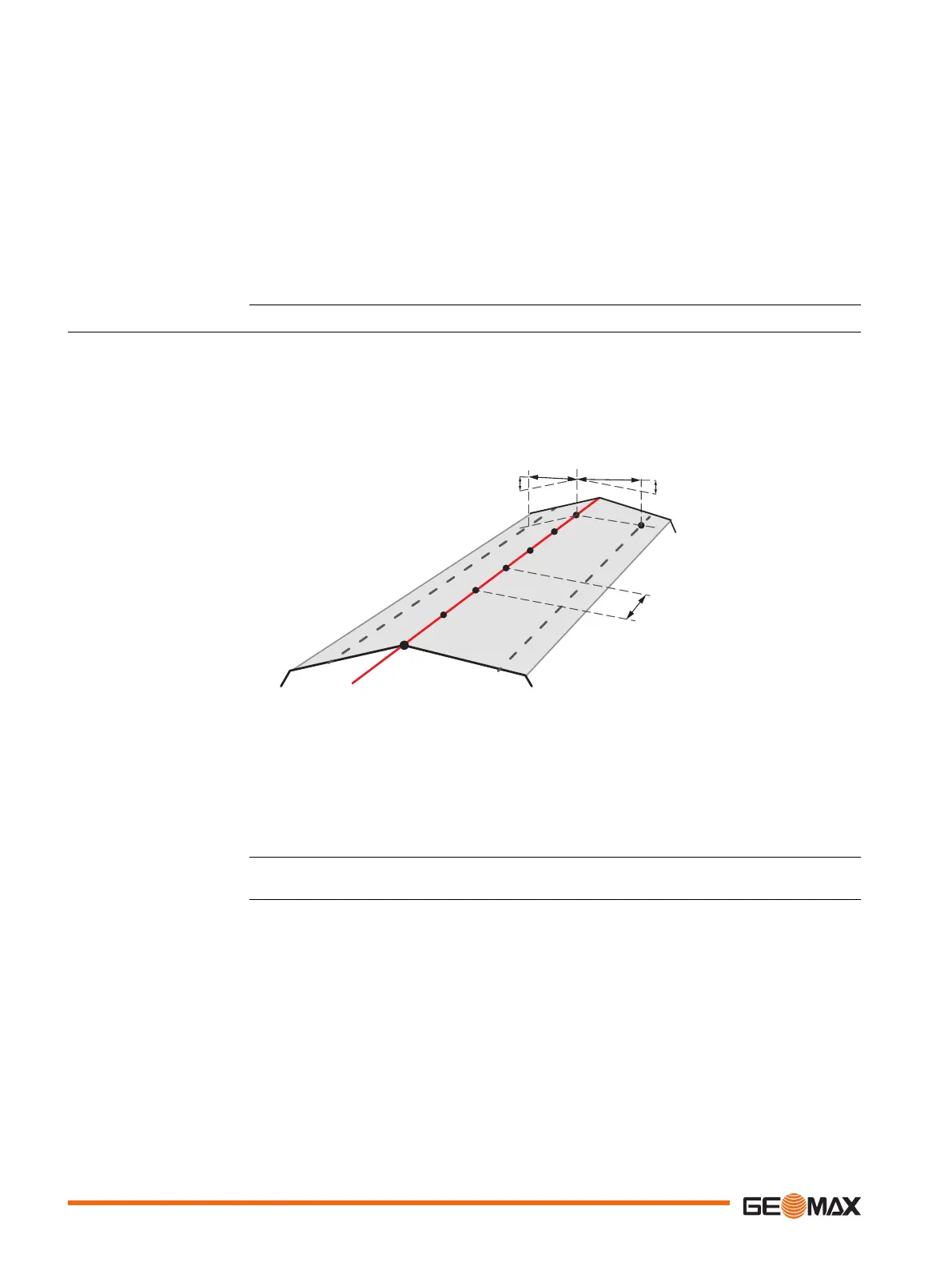
Chainage, incremental stakeouts and offsets (left and right) are supported. Stake out the centre-
line first, then left and right pile.
b
a
c
d
e
f
560
550
540
530
520
18982_001
a Left elevation: vertical distance between left pile and centreline
b Left offset: horizontal distance between left pile and centreline
c Right offset: horizontal distance between right pile and centreline
d Right elevation: vertical distance between right pile and centreline
e Increment
f Centreline
Select Road Stakeout (4) from the Road menu.
Description
Access
74 Application

 Loading...


