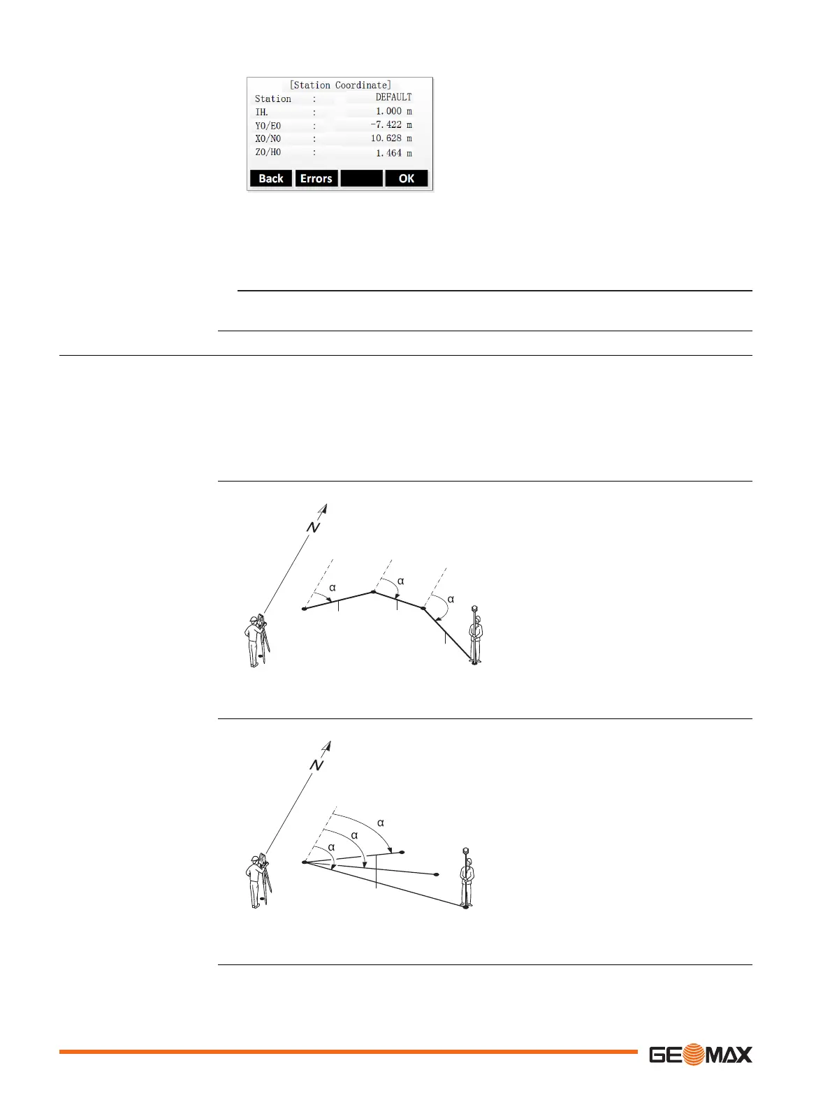
Errors To display the standard deviation.
Step-by-step
1.
•
To measure another target point, press Back.
•
To display the standard deviation, press Errors.
2. To set the station and exit the application, press OK.
9.5 Tie Distance
Tie Distance is an application used to compute slope distance, horizontal distance, height differ-
ence and azimuth of two target points which are either measured, selected from the memory, or
entered using the keypad.
The user can choose between two different methods:
•
Polygonal: P1-P2, P2-P3, P3-P4.
•
Radial: P1-P2, P1-P3, P1-P4.
TSOX_046
P1
P0
P2
P3
P4
Hz = 0
d3
d2
d1
1
2
3
P0 Instrument station
P1-P4 Target points
d1 Distance from P1-P2
d2 Distance from P2-P3
d3 Distance from P3-P4
a1 Azimuth from P1-P2
a2 Azimuth from P2-P3
a3 Azimuth from P3-P4
TSOX_047
P1
P0
P2
P3
P4
Hz = 0
d1
d3
d2
1
2
3
P0 Instrument station
P1-P4 Target points
d1 Distance from P1-P2
d2 Distance from P1-P3
d3 Distance from P1-P4
a1 Azimuth from P1-P4
a2 Azimuth from P1-P3
a3 Azimuth from P1-P2
Result screen
Description
Polygonal method
Radial method
58 Application

 Loading...


