The baseline is fixed by two base points. All points can be either measured, manually entered, or
selected from the memory.
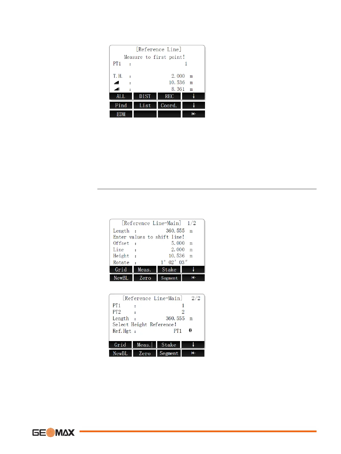
Defining the baseline
1. Set the first base point.
Next step
Define the reference line.
The baseline can be offset from, either longitudinally, in parallel or vertically, or be rotated
around the first base point. This new line created from the offsets is called the reference line. All
measured data refers to the reference line.
Softkey level 1
Grid To stake out a grid relative to
the reference line.
Meas. To measure line and offset
Stake To stake out points orthogonal
to the reference line.
Softkey level 2
NewBL To define a new baseline.
Zero To reset all offset values to 0.
Segment To subdivide a reference line
into a definable number of
segments and stake out the
new points on the reference
line.
Define the baseline
Define the reference line
Application 77

 Loading...


