9. Navigation and guidance system
MiR600 User Guide (en) 08/2021 - v.1.0 ©Copyright 2021: Mobile Industrial Robots A/S. 87
If you are using the robot in an area with walls made of glass or reflective
material, mark the walls as Forbidden zones on the map, not as walls—see
Creating and configuring maps on page130. Walls on the map that the robot
cannot detect will confuse the robot's navigation system.
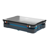
3Dcameras
Two 3D cameras positioned on the front of the robot detect objects in front of the robot. The
3D cameras detect objects:
• Vertically up to 1800 mm at a distance of 1200 mm in front of the robot.
• Horizontally in an angle of 114° and 250 mm to the first view of ground.
From the floor plane, the robot does no detect objects below 30mm from the ground.This
value increases by 10mm per meter from the robot.
The 3D cameras are only used for navigation. They are not part of the robot's safety system.
CAUTION
The 3Dcameras cannot be used as a means for safety related risk reduction,
for example, detecting low hanging obstacles. They cannot be used as an
alternative to the Personnel detection safety function—see Personnel
detection on page102. The robot may collide with and cause injury to
personnel if you rely on the 3D cameras alone to detect personnel.
• Do not modify the safety laser scanner settings with the expectation that
the 3D cameras will prevent collision with personnel.
• Do not include the 3D cameras as a risk reduction means in your risk
assessment of the robot.
The camera readouts are used as 3D point cloud data. They are not recording
recognizable objects or people.