152
DECLINATION
Magnetic Declination is taken from numbers provided on maps
and/or charts that apply to a specific location. The numbers
represent the easterly or westerly angular difference (Declina-
tion) in degrees between magnetic North and true (geometric or
polar) North. A Compass will point to magnetic North unless its
reference is adjusted to true North prior to conducting activities.
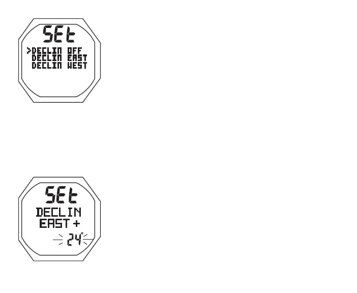
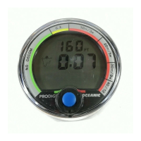
The Declination Menu displays the graphic SEt with selections
OFF, East, and West (Fig. 152).
• S (< 2 sec) - to access selection
> If OFF, both East and West Declination is set for 0° and
operation reverts to the Compass Menu.
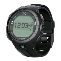
Set Declination, information includes (Fig. 153) -
> Graphics SEt and DECLIN
> Graphic EAST + (or WEST - )
> Declination value flashing with ° icon
• A (hold) to scroll upward through Set Points at a rate of 8
per second from 0 to 45° in increments of 1°
• A (< 2 sec) to step upward through Set Points one at a time
• M (< 2 sec) to step back through Set Points one at a time
• S (< 2 sec) to save the setting and revert to the Set
Declination Menu
Fig.152-DECLINATION
SETMENU
Fig.153-SETDECLIN