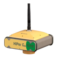
Setup and Survey
Topcon HiPer Lite and HiPer Lite+ Operator’s Manual
3-2
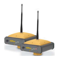
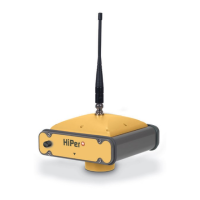
Step 1: Set up the Receiver
This section assumes the receiver has been configured using
PC-CDU.
1. Place the receiver on the appropriate tripod or bipod.
2. Center the receiver over the point at which data will be
collected. For most applications, this should be at a location
with a clear view of the sky.
Step 2: Measure Antenna Height
The location of the antenna relative to the point being measured
is very important for both surveys in which the elevation of the
points is important and in surveys for horizontal location only.
Horizontal surveys are often larger in area than can reliably fit
on a flat plane, therefore the antenna adjustment must be done
in three dimensions and then projected onto a two dimensional
plane.
The receiver calculates the coordinates of the antenna’s phase
center. To determine the coordinates of the station marker, the
user must specify the following:
• Measured height of the antenna above the station marker
• Method of measuring the antenna height
• Model of the antenna used
Antennas have two types of measurements:
• Vertical – measured from the marker to the antenna
reference point (ARP) located on the bottom of the receiver
at the base of the mounting threads.
• Slant – measured from the marker to the lower edge of the
antenna slant height measure mark (SHMM) located on
both end panels of the receiver.