5
GPS OPERATION
5-8
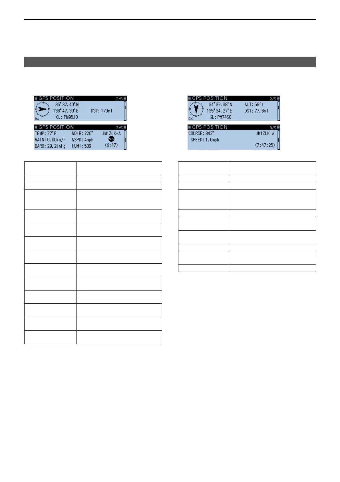
D TX format: D-PRS
Weather
Displays the following items when the caller’s TX
format is D-PRS Weather.
Compass
Displays the caller’s direction
from your location
Latitude Displays the caller’s latitude
Longitude Displays the caller’s longitude
GL
Displays the grid locator based
on the caller’s latitude and
longitude
DST
Displays the caller’s distance
from your location
TEMP
Displays the temperature of the
caller’s area
RAIN
Displays the rainfall of the
caller’s area
WDIR
Displays the wind direction of the
caller’s area
WSPD
Displays the wind speed of the
caller’s area
BARO
Displays the barometric pressure
of the caller’s area
HUMI
Displays the humidity of the
caller’s area
Symbol
Displays the caller station’s
D-PRS symbol
GPS Time Stamp
Displays the time that the caller
acquired the weather data.
Call sign
Displays the caller’s call sign
(with SSID)
D TX mode: NMEA
Displays the following items when the caller’s TX
mode is NMEA.
Compass
Displays the caller’s direction
from your location
Latitude Displays the caller’s latitude
Longitude Displays the caller’s longitude
GL
Displays the grid locator based
on the caller’s latitude and
longitude
ALT Displays the caller’s altitude
DST
Displays the caller’s distance
from your location
COURSE
Displays the caller’s direction
over ground
SPEED Displays the caller’s speed
GPS Time Stamp
Displays the time that the caller
acquired the position data.
Call sign Displays the caller’s call sign
Checking your location (Continued)