9.12Chartpresentation
Thecharthasanumberofpresentationoptionswhichaffectthe
levelofdetail,typesofobjectsandaspectsofitsoperation.
Thepresentationoptionsavailableare:
•Chartdetail—Setthelevelofobjectdetailshownonthechart.
•Layers—Setcontentlayerswhichcanbeoverlaid.
•ChartView—Toggle2Dand3Dperspectiveview.
•2DChartUse—Selectshingcharts(ifsupportedbyyour
chosenchartsupplier)orstandardnavigation.
•ChartOrientation—Settheorientationofthechartapplication.
•MotionMode—Setthemotionmodeforthechartapplication
(onlyavailablein2Dview).
•VesselOffset—Setthevesseloffsetfromthecentreofthe
screen(onlyavailablein2Dview).
•ChartSync—Synchronizetheradarandchartscales.
•DataOverlaySet-up—Enabledatacellsinthechartapplication.
Accessingchartpresentationoptions
Fromthechartapplication:
1.SelectMenu.
2.SelectPresentation.
Chartdetail
5
5
9
14
9
14
5
5
9
14
9
14
D117 57-2
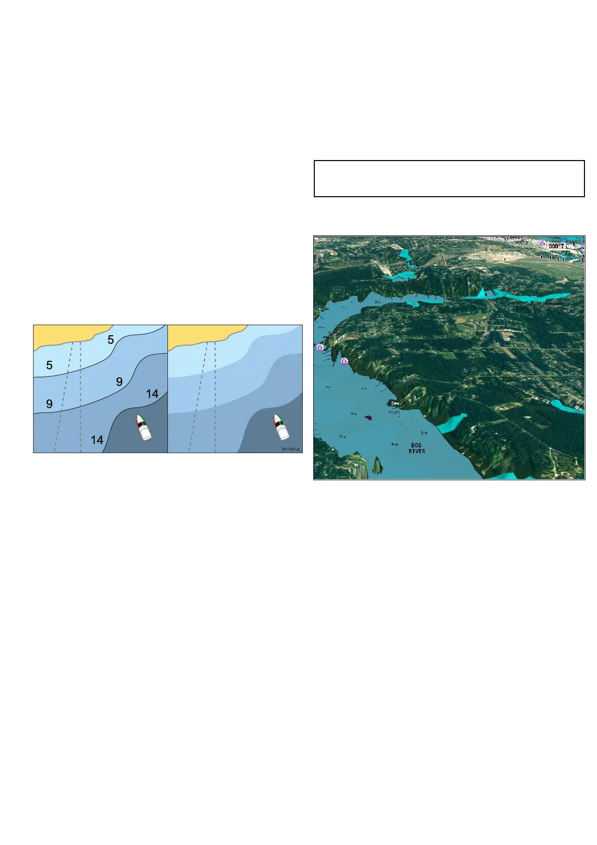
Thechartdetailsettingdeterminestheamountofcartographicdetail
showninthechartapplication.
SelectingtheLowoptionfortheChartDetailhidesthefollowing
cartographicobjects:
•T ext.
•Chartboundaries.
•Spotsoundings.
•Depthcontours.
•Lightsectors.
•CautionandroutingData.
•Landandmarinefeatures.
•Businessservices(ifavailableforyourchartcard).
SelectingtheHighoptionshowstheseobjects.
Changingthelevelofchartdetail
Fromthechartapplication:
1.SelectMenu.
2.SelectPresentation.
3.SelectChartDetailtoswitchbetweentheHighorLowoption,
asappropriate.
Chartlayers
Thecharthasanumberofcontentlayersprovidingdifferentkindsof
displayandinformation.
Youcanoverlaythefollowingdataontoa2Dchartwindowtogive
greaterdepthofinformation.Theoverlaysavailableare:
•Aerial—Providesanaerial/satellitephotographyoverlay.
•AIS—ViewandtrackAIStargets(2Dviewonly).
•Radar—Overlayradarontothechart(2Dviewonly).
•NOWRad—ProvidestheNOWRadweatherradaroverlay,
withouttheneedtoopenaseparateweatherapplicationwindow
(2Dviewonly).
•MyData—Allowsyoutoselectwhichwaypoints,routesand
trackstodisplay.
•Vectors—ViewheadingandCOGvectorsortideandwind
arrows(2Dviewonly).
•RangeRings—Viewradarrangerings(2Dviewonly).
•3DDisplayOptions—Provides3Doptions:CentreofView,
Exaggeration,TransducerConeandDepthScale(3Dviewonly).
Note:Thelayersrequireelectronicchartswiththeappropriate
featuresupportandmayalsorequireadditionalhardwareand
servicesubscriptions.
Aerialphotooverlay
Yourelectronicchartsmayincludeaerialphotography.
Aerialphotoscoverthenavigablewatersupto3milesinsidethe
coastline.Theresolutionisdependentontheregioncoveredby
thechartcard.
Enablingaerialphotooverlay
Fromthechartapplication:
1.SelectMenu.
2.SelectPresentation.
3.SelectLayers.
4.SelectAerialsothatOnishighlighted.
Theopacitybarisdisplayedshowingthecurrentopacity
percentage.
5.UsetheRotaryControltoadjusttheopacitytotherequired
percentage.
Specifyingtheaerialoverlayarea
Fromthechartapplication.
1.SelectMenu.
2.SelectSet-up.
3.SelectCartography.
4.SelectAerialOverlay.
Alistofoverlayoptionsisdisplayed.
5.SelecteitherOnLand,OnLandandShallows,orOnLandand
Sea.
Atickisdisplayednexttotheoptionandifaerialoverlayis
switchedonthescreenisredrawnshowingthenewoverlay
selection.
Usingthechart
107

 Loading...


