Radaroverlay
YoucancombinethechartwiththeradarandMARPAfunctions
toprovidetargettrackingortohelpyoudistinguishbetweenxed
objectsandothermarinetrafc.
Youcanenhancetheuseofyourchartbycombiningitwiththe
followingradarfeatures:
•MARPA.
•Radaroverlay(fordistinguishingbetweenxedandmoving
objects).
UsingtheradartoviewMARPAtargetsonthechart
TheMiniAutomaticRadarPlottingAid(MARPA)functionisusedfor
targettrackingandriskanalysis.Whentheradaroverlayison,all
MARPAtargetsaredisplayedinthechartwindowandassociated
MARPAfunctionscanbeaccessedviathechart.
Usingradaroverlaytodistinguishbetweenxedandmoving
objects
Youcanoverlayradarimagedataoveryourchartimageallowing
betterdistinctionbetweenxedobjectsandothermarinetrafc.For
bestresults,switchonRadar-Chartsynchronizationtoensureradar
rangeandchartscalearesynchronized.
Enablingradaroverlay
Withtheradarturnedonandtransmitting,withthechartapplication
in2Dview:
1.SelectMenu.
2.SelectPresentation.
3.SelectLayers.
4.SelectRadarsothatOnishighlighted.
Theopacitybarisdisplayedshowingthecurrentopacity
percentage.
5.UsetheRotaryControltoadjusttheopacitytotherequired
percentage.
Accessingradarcontrolsonthechart
Fromthechartapplication:
1.SelectMenu.
2.SelectRadarOptions.
Note:Anychangesmadetotheradaroptionsfromthechart
applicationwillbeappliedtotheradarapplication.
Chartscaleandradarrangesynchronization
Youcansynchronizetheradarrangeinallradarwindowswiththe
chartscale.
Whensynchronizationisswitchedon:
•Theradarrangeinallradarwindowschangestomatchthechart
scale.
•‘Sync’isindicatedinthetopleft-handcornerofthechartwindow.
•Ifyouchangetheradarrange,inanyradarwindow,all
synchronizedchartviewschangescaletomatch.
•Ifyouchangethescaleofasynchronizedchartwindow,allradar
windowschangerangetomatch.
Synchronizingthechartandradarrange
Inthe2Dchartview:
1.SelectMenu.
2.SelectPresentation.
3.SelectChartSync.
4.SelectRadar.
Note:Radarrangesynchronizationisnotavailablewhenthe
chartmotionmodeissettoAUTORANGE.
NOWRadweatheroverlay
Withasuitableweatherreceiverconnectedtoyourmultifunction
display,youcanoverlayNOWRadweatherinformationonthechart
display.
TheNOWRadweatheroverlayprovidesNOWRadweather
informationandreportsinthechartapplication.Youcanadjustthe
intensityoftheoverlaytoachieveoptimalvisibilityofbothchart
andweatherinformation.
Note:TheNOWRadweatheroverlaycanonlybeusedinNorth
Americaanditscoastalwaters.
EnablingNOWRadweatheroverlayonthechart
Inthe2Dchartview:
1.SelectMenu.
2.SelectPresentation.
3.SelectLayers.
4.SelectNOWRadsothatOnishighlighted.
SelectingNOWRadwillswitchtheweatheroverlayOnandOff.
Viewingweatherreportsfromthechartapplication
Inthe2Dchartview:
1.SelectMenu.
2.SelectWeatherReports.
3.SelectReportAttoswitchbetweenweatherreportsfromShip
orCursorlocation.
4.SelecteitherTropicalStatements,MarineWarnings,Marine
ZoneForecasts,orWatchboxWarnings.
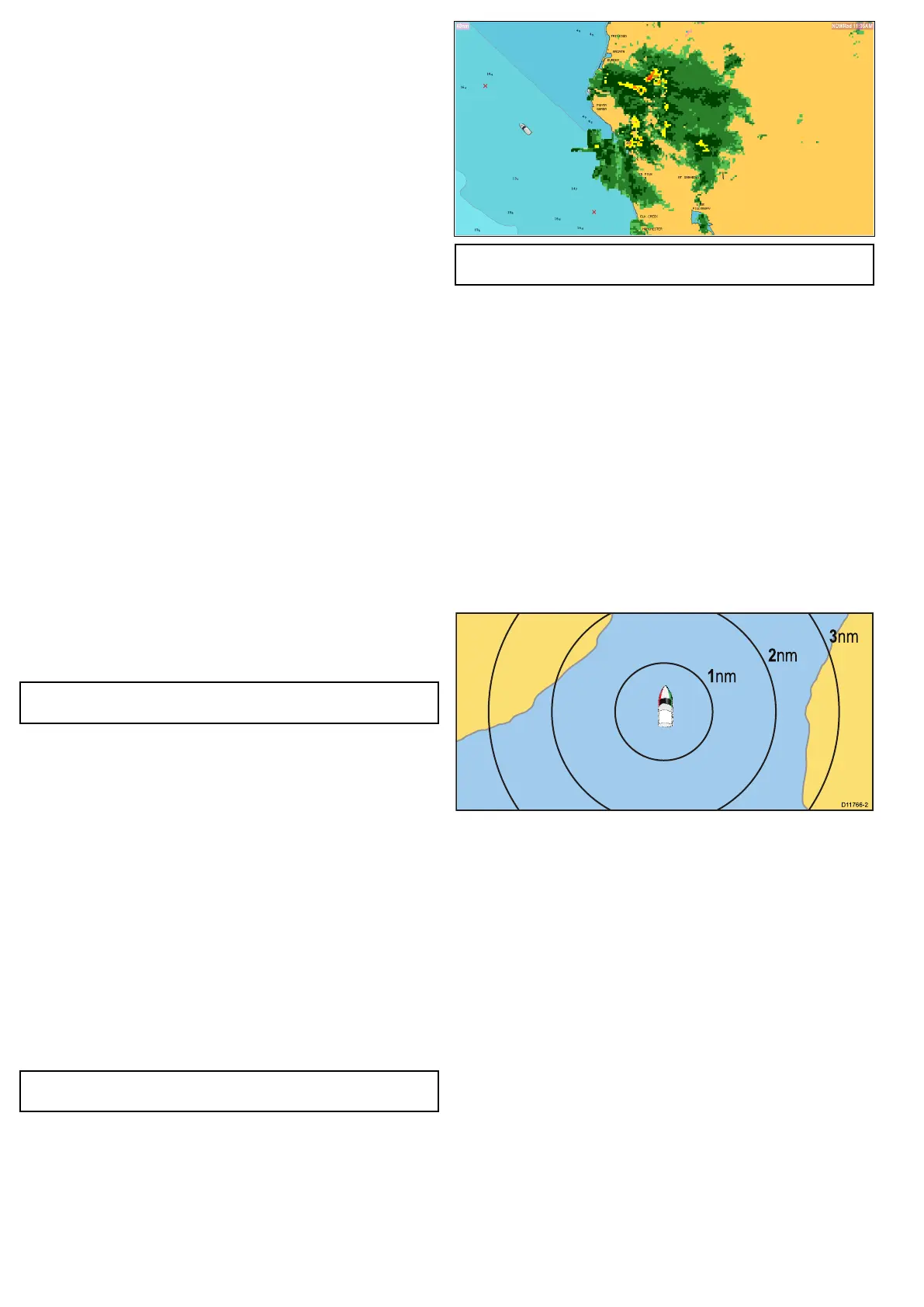
Rangerings
Rangeringsgiveyouanincrementalrepresentationofdistance
fromyourvesseltohelpyoujudgedistancesataglance.Therings
arealwayscentredonyourvessel,andthescalevariestosuityour
currentzoomsetting.Eachringislabelledwiththedistancefrom
yourvessel.
Enablingrangerings
Inthe2Dchartview:
1.SelectMenu.
2.SelectPresentation.
3.SelectLayers.
4.SelectRangeRingssothatOnishighlighted.
SelectingrangeringswillswitchrangeringsbetweenOnandOff.
3DDisplayOptions
Thefollowingoptionsareavailablewiththechartapplicationin3D
view:
•CentreOfView—Switchesacrosshaironandoffatthecentre
ofthescreenatsealevel.
•Exaggeration—Adjustingtheexaggerationhastheeffectof
verticallystretchingobjectsonthechart,makingiteasiertosee
theirshapeandposition.
•TransducerCone—Switchesonandoffatransducercone
indicatingthecoverageofashndertransducer.
•DepthScale—Switchesonandoffadepthscaleatyourvessel
position.
108e7/e7D/e95/e97/e125/e127/c95/c97/c125/c127
 Loading...


