AutoRangeselectsandmaintainsthelargestpossiblescaleofchart
thatwilldisplayboththevesselandthetargetwaypoint.Autorange
isnotavailableifradar-chartsynchronizationison.
Settingthemotionmode
Fromthechartapplication:
1.SelectMenu.
2.SelectPresentation.
3.SelectMotionMode.
4.SelectTrueMotion,RelativeMotion,orAutoRangeoptionas
appropriate.
Onceselectedatickwillbeplacednexttothechosenmotionmode
andthescreenwillupdatetoreectthenewmode.
Changingthevesseloffsetvalue
Fromthechartapplication:
1.SelectMenu.
2.SelectPresentation.
3.SelectVesselOffset.
4.Select0,1/3,or2/3optionasappropriate.
Locatingyourvessel
1.SelecttheFindShipicon:locatedonthelefthandside
ofthescreen.
Note:YoucanalsoaccesstheFindShipfunctionfromthemenu:
Menu>FindShip.
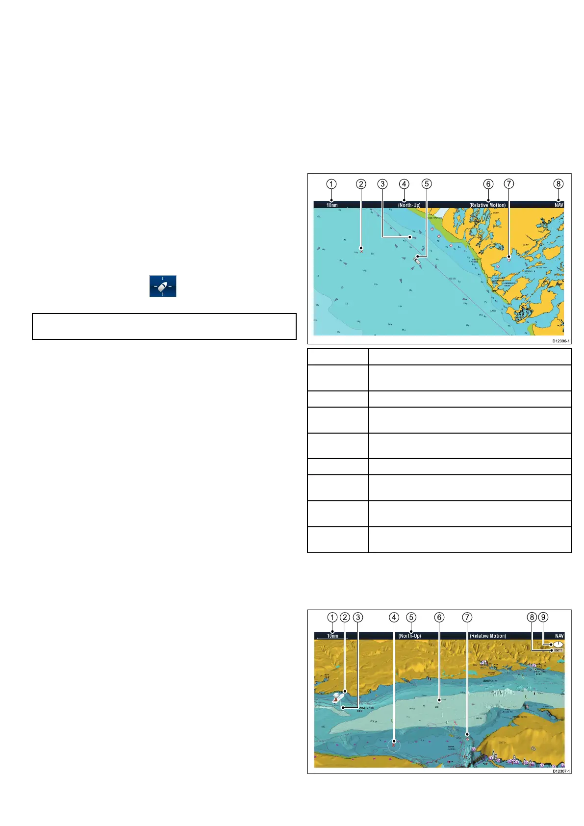
9.3Chartviews
Switchingbetween2D/3Dchartview
Youcanswitchbetween2Dand3Dviews.
Fromthechartapplication:
1.SelectMenu.
2.SelectPresentation.
3.SelectChartViewtoswitchbetween2Dor3D.
2Dchartview
The2Dchartviewcandisplayarangeofinformationtohelpyou
navigate.
ItemDescription
1
Range—horizontalchartscaleindicator(showninselected
systemunits).
2
Waypoint(optional)
3
AIStarget—avesselbroadcastingAISinformation
(optional).
4
Orientation—statestheorientationmodethatthechartis
using(North-up,Head-up,orCourse-up).
5
Vesselsymbol—showsyourcurrentposition.
6
Motionmode—statesthecurrentmotionmode(Relative,
True,orAutoRange).
7
Cartographicobjects—usetheCartographymenu:Menu
>Set-up>Cartographytochoosewhichobjectstodisplay.
8
Charttype—indicatesthetypeofchartinuse—Fishor
Navigation.
3Dchartview
The3Dviewcandisplayandrangeofinformationtohelpyou
navigate.
Usingthechart
99
 Loading...


