CA42/50/52 NAV menus & navigation examples Chapter 6
68
Route: RTE 3 5
BN: 16.4° TDG: 35.7nm TTG: 2h34m
S8.2
V7.4
C359
°
°°
°
B314
°
°°
°
X0.011
D17.3
0.04nm
0.02nm
0.02nm
0.04nm
0.02nm
0.02nm
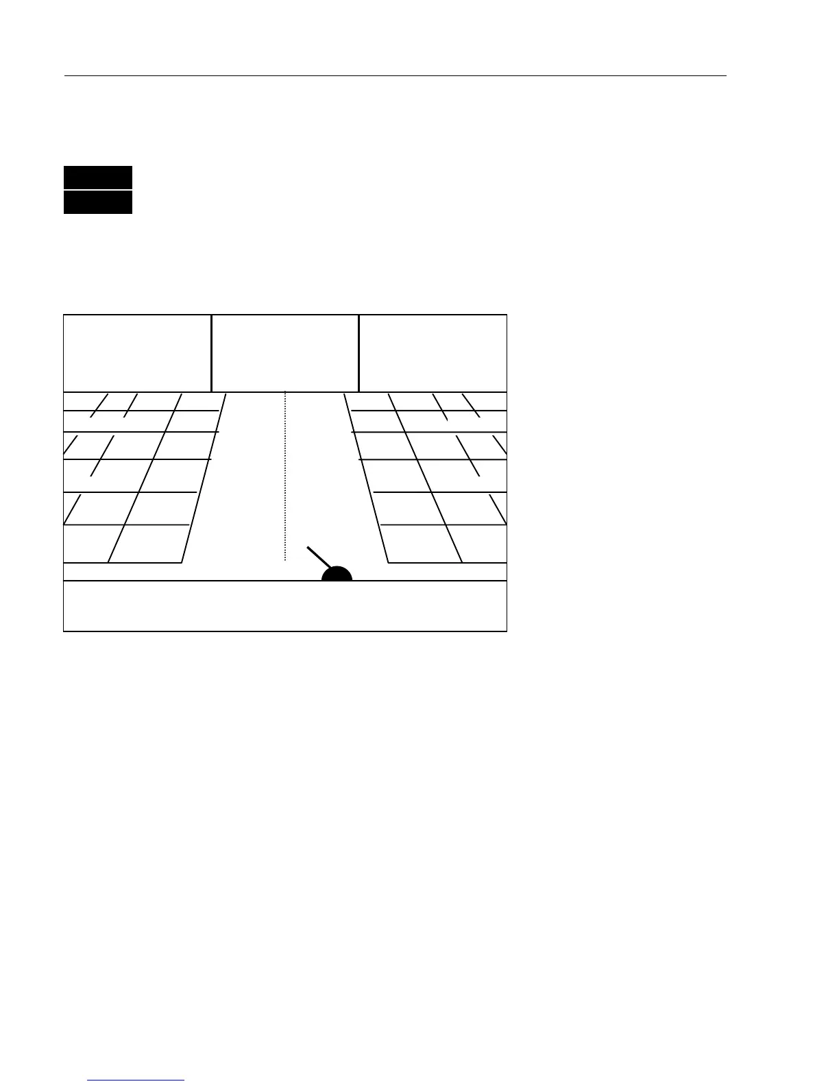
6.2.1 Highway display
MENU
Call up the menu bar, and…
4,1
load Highway display
With navigation mode active, the highway display will provide a
graphical steering display:
C: Course over ground
X: XTE – Cross-track-error
S: Speed over ground
B: Bearing to approaching
point
D: Distance to approaching
point
V: Speed towards point
Route: Name of active
route
Point: No. of approaching
point
TDG: Total distance to go
BN: Bearing to next point
TTG:Timetogo(onlyfor
waypoint navigation).
n
Ship’s position and course in relation to intended track.
n
o
Intended track between two waypoints or from ship’s position when
NAV is activated.
p
XTE alarm lines – an alarm will be activated if the ship moves across
the lines (if the alarm is enabled).
Refer to section 6.1.1 for alarm setup.
n
o
p
p