18
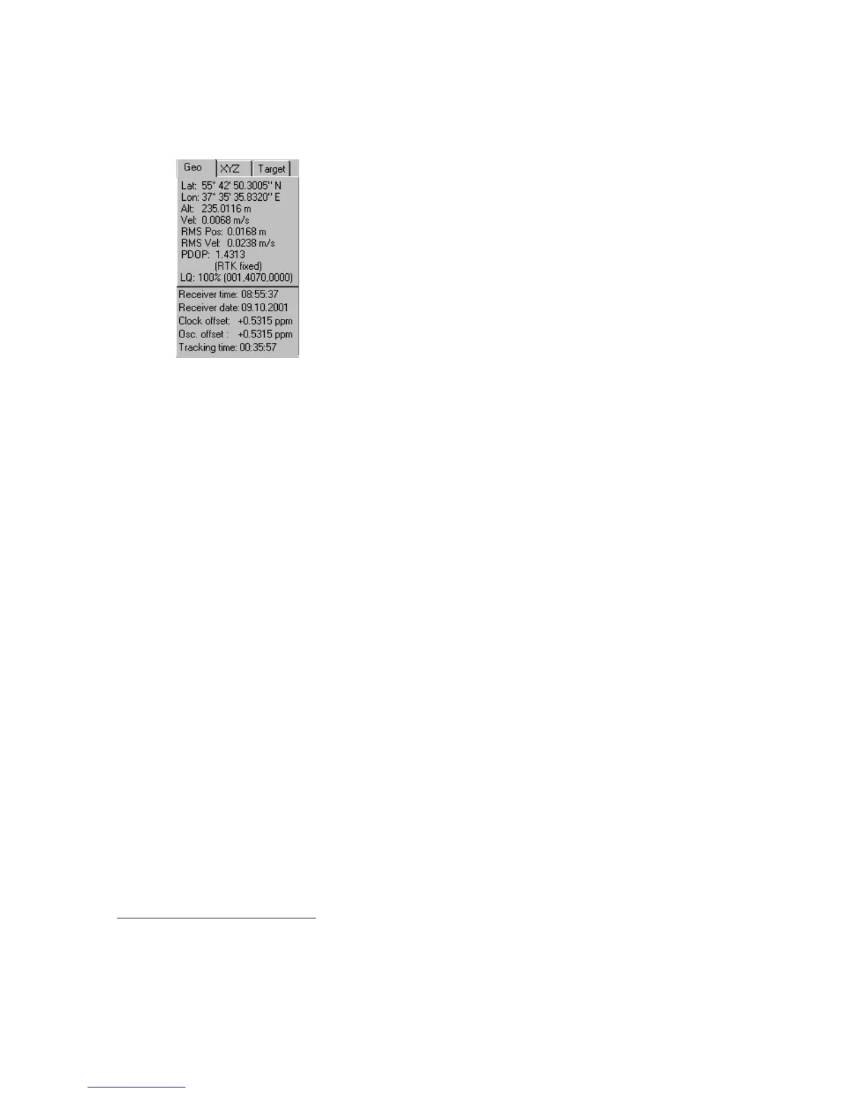
4.1.1. Geo tab
The Geo tab shows the receiver’s antenna’s current position and the time-frequency parameters
describing the behavior of the receiver’s local oscillator (Figure 10):
Figure 10. “Geo” tab
• Geodetic coordinates
6
- Lat – latitude;
- Lon – longitude;
- Alt – ellipsoidal height.
• Vel – (magnitude of the) velocity (m/s).
• RMS Pos – rms position error
7
(m).
• RMS Vel – rms velocity error
8
(m/s).
• PDOP – Position dilution of precision.
• Solution type:
♦ Standalone
♦ Code differential
♦ RTK float
♦ RTK fixed
• LQ – This field reflects the status of the received differential messages and contains
the following information:
♦ Data link quality in percentage.
♦ Time (in seconds) elapsed since the last received message.
♦ Total number of received
correct
messages.
♦ Total number of received
corrupt
messages.
6
These geodetic coordinates are computed in WGS 84 regardless of the current value of the
/par/pos/datum/cur parameter. For more details on this parameter, see the GRIL Reference manual.
7
More precisely, this is the square root of the trace of the position error covariance matrix.
8
More precisely, this is the square root of the trace of the velocity error covariance matrix.