3-7
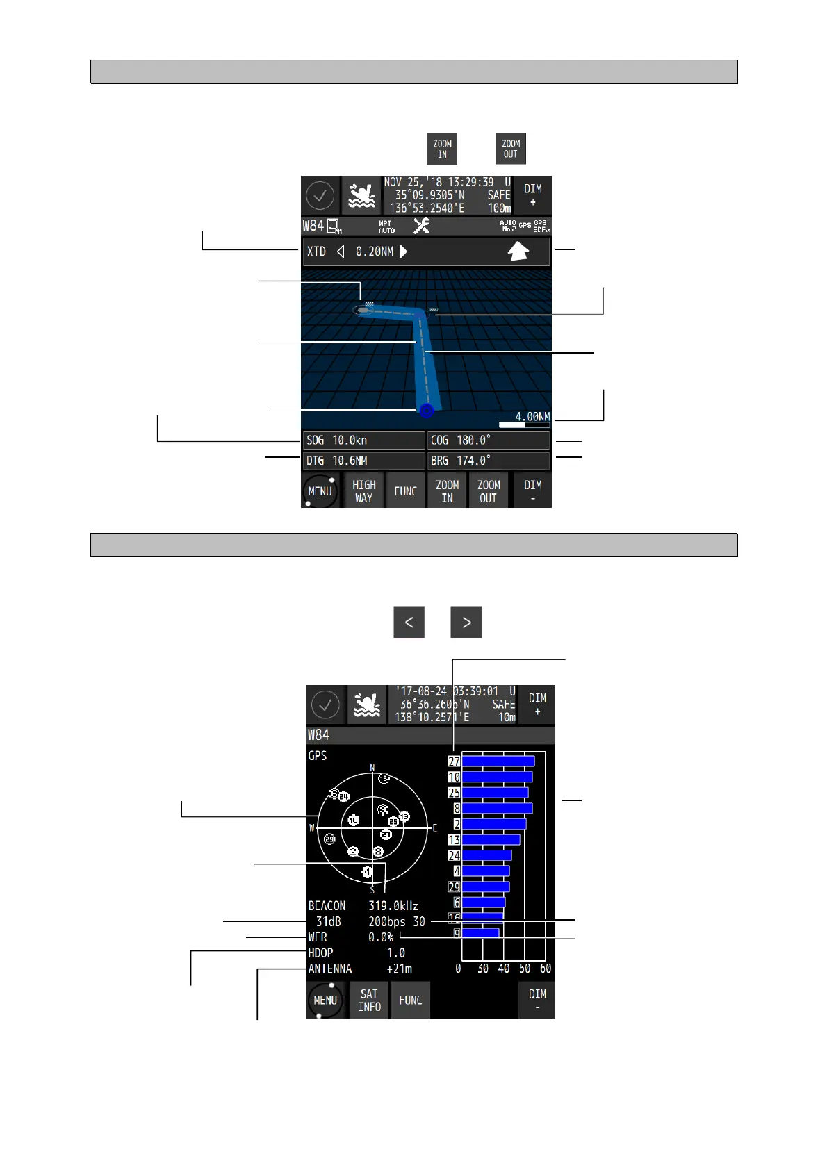
3.1.6 Highway screen
The highway screen displays the CDI, course, speed, bearing, and distance.
The screen can be enhanced or reduced by using and respectively.
3.1.7 Satellite information screen
The satellite information screen displays the GNSS satellite and the beacon reception state.
The GNSS system can be switched by using or .
Waypoint direction
Next waypoint
Waypoint
Route
LEG
Scale bar
Own ship Speed
Course
Distance from the own
ship's position to the
waypoint
Bearing from the own
ship's position to the
waypoint
Deviation from the route
and the steering direction
GNSS satellite location
and the receiving status
Unframed: Search
: Completion of
demodulation
: Use of position fixing
GNSS satellite number
Unframed: Search
□ : Completion of
demodulation
■ : Use of position fixing
GNSS signal intensity bar
45 to 55 under normal
conditions
Beacon frequency
Beacon SNR
Beacon error rate
GNSS HDOP
ntenna height
Beacon bit rate
Beacon signal intensity

 Loading...
