Chart shading
Shading adds terrain information to the chart.
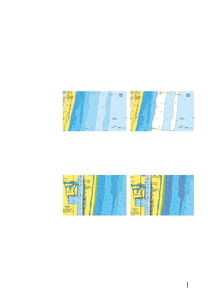
Fishing range
Select a range of depths between which Navionics fills with a white
color.
This allows you to highlight a specific range of depths for fishing
purposes. The range is only as accurate as the underlying chart data,
meaning that if the chart only contains 5 meter intervals for contour
lines, the shading is rounded to the nearest available contour line.
No Depth highlight range Depth highlight range: 6 m - 12 m
Shallow water highlight
This highlights areas of shallow water between 0 and the selected
depth (up to 10 meters/30 feet).
No shallow water highlighted Shallow water highlight: 0 m - 3 m
Safety depth
The Navionics charts use different shades of blue to distinguish
between shallow and deep water.
Safety depth, based on a selected limit, is drawn without blue
shading.
Charts | GO XSE/XSR Operator Manual
47